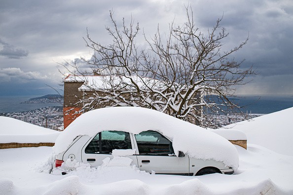
Americans should prepare for more severe winter weather in the coming weeks.

Chances of Extreme Weather Events
More possibilities of snow and other severe weather are expected in areas of the eastern United States on Monday, shortly after a winter storm wreaked havoc across the Tennessee Valley, Southeast, and up the Eastern Seaboard into New England over the weekend.
Following a brief period of warmer temperatures that may allow for a modest thaw in some storm-hit areas, another wave of Arctic air will move southeastward from Canada on Wednesday and Thursday.
Cold Air
The leading edge of the cold air, known as a cold front, usually causes a spell of rain before dry air takes possession. However, in certain situations, the cold air can catch up with the rain's backside and turn it into sleet or a mix of sleet and snow. And, mainly when a light storm develops along the front, the atmosphere can push the changeover even farther by triggering snowfall significant enough to build within a limited zone, which is precisely the sequence of events that could occur in the coming days.
According to AccuWeather Chief On-Air Meteorologist Bernie Rayno, "the energy for this storm was moving onshore along the Pacific coast on Monday, and if that catches up to the front in a certain way, there could be a narrow, sneaky zone of 3 inches of snow from parts of the Tennessee Valley to the lower mid-Atlantic coast in the Wednesday night to Thursday time frame."
The switch from Tennessee and Kentucky to West Virginia is expected to occur Wednesday night, and it may also extend into northern Mississippi and Alabama. During Wednesday night, scattered rain and snow showers associated with the frontal passage are expected across north Maryland, Pennsylvania, north of New Jersey, and the remainder of the Northeast.
Plunging temperatures can cause untreated wet and slushy areas to freeze, resulting in slick places on roads, sidewalks, and parking lots, even in locations that have a period of rain, rain showers, or non-accumulating snowflakes.
Low temperatures can freeze untreated wet and slushy patches on roadways, sidewalks, and parking lots, even in locations that just had a few days of rain, rain showers, or non-accumulating snowfall.
Another One Incoming
After the next winter storm, another one might be on the way shortly.
"This isn't the only storm we have to keep an eye on this week," Rayno said, adding that a stronger storm might form along the front on Friday and travel northward along the Atlantic coast on Friday night and Saturday.
"This week, another new infusion of Arctic air will enter the Northeast, and as we saw with the last storm, it can lay the setting for a large storm," Rayno explained.
Temperatures are expected to drop as low as, or perhaps a few degrees lower, late this week than they did early last weekend due to the previous winter storm. Temperatures plummeted across the eastern United States last weekend, with the mercury plummeting to 28 degrees below zero in the Adirondacks of northern New York state on Sunday morning ahead of the storm's arrival.
As well as unusually chilly temperatures, other regions were also experiencing the same phenomenon.
On Sunday morning, the temperature went below 20 degrees Fahrenheit for the first time in 1,078 days at Washington Reagan National Airport in Washington, D.C. It was 17 degrees below zero. In 2001-2002, the previous record was 428 days.
The jet stream and how far west its downward dip will extend will be a critical meteorological component in deciding if another severe storm forms over the Atlantic seaboard.
According to Rayno, "should the jet stream dip set up exactly along or just off the coast, the storm would be blown out to sea before traveling too far north on the Atlantic shoreline early this weekend."
High pressure over New England, on the other hand, may obstruct the storm's route and prevent it from going out to see if the jet stream dips back into the Appalachians.
Cold Weather All Over the US

Between Friday and early Saturday, there is the possibility for enough snow, or a mix of snow and ice, to cause travel issues for individuals in areas from Georgia through the Carolinas, Virginia, Delaware, Maryland, and southern New Jersey.
Winter traffic and delays are expected along with interstates 20, 26, 40, 77, 81, 85, and 95 in the coming weeks. The storm might also affect airline travelers whose flights depart from, arrive in, or connect through Atlanta and Charlotte's main southern U.S. hubs.
Instead of pure rain, which is more common at this time of year, ice or snowy blend may develop to the Carolinas, Georgia, and Virginia coastal areas if the storm takes a more southern course.
After then, the weather pattern will stay busy.
Over the following few weeks, there will undoubtedly be other storms with patches of snow and ice every several days. "Over the next seven days, the pattern is 'heavy' with three wintry possibilities in the Eastern states," Rayno added.
For more news about the environment , don't forget to follow Nature World News!
© 2026 NatureWorldNews.com All rights reserved. Do not reproduce without permission.


