Experts warn that the reasonably tranquil, albeit frigid, weather pattern that sets into parts of the Midwest and Northeast during the second week of January may be short-lived, as they keep an eye on the long-range prediction for additional weather difficulties and any storms.
According to weather meteorologists, a storm originating in western Canada will move southeastward, bringing a large zone of accumulating snow from sections of the Plains and Midwest late this week to parts of the South and interior Northeast this weekend, resulting in slick travel conditions.
Crossing Between Different Temperature Zones
AccuWeather Chief On-Air Meteorologist Bernie Rayno predicted that "the storm would operate within and travel along a temperature difference zone." After Wednesday, while the chilly air that has gripped the Midwest and Northeast will go, the second round of cold weather will arrive later this week and this weekend. By Friday, high temperatures in northern New England will be in the single digits. Meanwhile, temperatures will rise into the 40s in sections of the central Plains on the other side of the jet stream.
As the second wave of cold air approaches, the storm will be an Alberta clipper that pushes southeastward late this week.
In western Canada, clipper storms often bring only light to moderate snow along a restricted zone as they pass quickly. Snow can fall over a large area if conditions allow, and heavy snow can fall if the storm strengthens and comes into touch with moisture.
While Minneapolis and Des Moines, Iowa, look to be in the path of snow accumulation, major cities farther east in the Midwest, including Chicago, Indianapolis. Cincinnati. Detroit. Louisville. Kentucky may have flakes flying for a period this weekend.
Weather Forecasts
Forecasters are exploring various possibilities for how the storm will behave once it enters the Appalachians later this weekend. The most crucial issue is: How quickly will the system move eastward and northward? The storm's potential to distribute snow throughout the Northeast states may be limited by the cold, dry air that may blow in so forcefully.
In the Northeastern states, dry air in situ is expected to be a factor against heavy snow falling too far to the north - at least initially. A Senior Meteorologist, Heather Zehr, stated, "It's conceivable that snow from the storm in the Great Lakes on Saturday and parts of the central Appalachians on Sunday will only be a dusting to an inch or two."
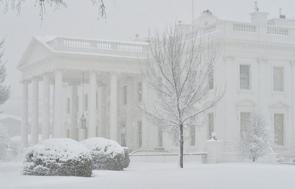
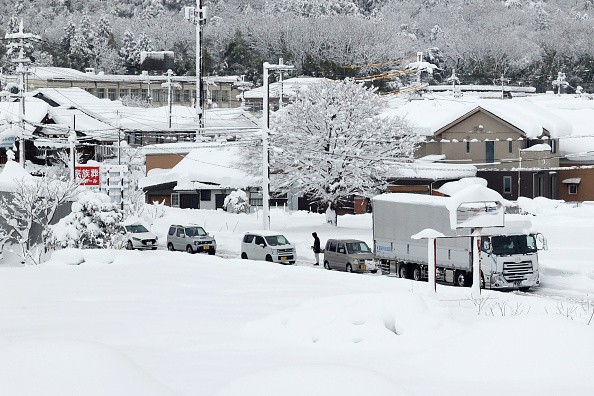
Large snowfalls that cross major airport hubs in the Midwest and Northeast, as well as extensive lengths of major roads, can result in significant airline delays and hazardous driving conditions for motorists.
Snow All Over
The storm allows snow to fall in sections of the southern Appalachians from late Saturday until early Sunday. On Sunday, a wintry mix or a rain-to-snow scenario might develop in eastern, lower-elevation parts of North Carolina and Virginia. By Sunday, a wintry mix might be seen in Raleigh, North Carolina, and Richmond, Virginia, with snow possible in Washington, D.C., Philadelphia, and perhaps New York City.
Because the storm is still a few days away, prediction modifications are probable once a firm trajectory and moisture overlay can be determined.
After that, once the clipper system reaches the mid-Atlantic coast early next week, it has the potential to strengthen fast.
Heavy snow and substantial traffic disruptions along the Interstate 95 corridor might result from this coastal progression. The likelihood of heavy snow, on the other hand, would be dependent on the storm's path.
Several days early, one of these storms would accomplish precisely that. From later Friday to Saturday, a storm that starts well off the mid-Atlantic coast is expected to turn northward, bringing heavy snow and severe winds to parts of Atlantic Canada. Any westward jog that might get snow to Boston and the coastal portions of New Hampshire and Maine will be monitored by meteorologists.
"For the time being, increased gusts and heavy waves seem to be the most significant consequences in eastern New England from the Atlantic Canada storm late this week and early this weekend," Senior Meteorologist Courtney Travis said.
Another Storm in the Horizon

Long-range meteorologists have a storm on the horizon for later next week, and they believe it will bring snowy weather to the East.
"If a storm takes the trajectory we expect occurs, the weather pattern from Jan. 20-22 favors significant snow and interruptions to school and commerce from the central Appalachians to the interior Northeast," Lead Long-Range Meteorologist Paul Pastelok said.
Over the next week or two, the polar vortex will continue to deliver waves of frigid air to the Midwest and Northeast, with a southern shift anticipated several weeks ago.
There is a continuation of the polar vortex's southerly relocation, according to Pastelok, as well as weather elements in the Pacific Ocean and jet stream patterns along the Atlantic seaboard later next week, suggesting that a storm might form.
Despite a lull in the early part of this week, the overall weather pattern for the Midwest and Eastern states will continue to operate in a reasonably typical January mode, which means that multiple storms are likely to evolve through the end of the month, with opportunities for accumulating snow and associated travel disruptions.
For more news about the environment , don't forget to follow Nature World News!
© 2026 NatureWorldNews.com All rights reserved. Do not reproduce without permission.


