AccuWeather forecasters say the central United States will continue to feel 60, 70, and even 80 degrees Fahrenheit colder than it was in recent weeks as a result of a winter storm that will come to an end this weekend.
People who spend a lot of time outside in the freezing weather may face risks of frostbite and hypothermia.
Central US to Experience Cold Snap
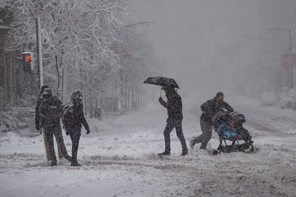
Cold weather gripped North Dakota on Saturday morning, with low temperatures ranging from 10 to 30 degrees below zero in some areas, according to Accuweather.
The highest and lowest temperatures varied by about 110 degrees between the northern and southern parts of the continental United States.
On Saturday, in contrast to much of the previous month, cold air pushed south across the Plains and continued to sweep eastward over parts of the Mississippi and Ohio Valleys as well as the Great Lakes region into the beginning of the new week.
In December, Chicago's average temperature was 7.5 degrees above the average of 31.5 degrees, placing the city in sixth place on the all-time list of warmest Decembers.
Temperatures fell 10 to 20 degrees below average as the cold air engulfed the area on Sunday morning. It was a chilly start to Sunday morning in Chicago, where AccuWeather RealFeel® Temperatures fell to just below zero.
Following a high in the 60s F on Friday in many parts of Kansas and Oklahoma, New Year's Day saw temperatures fall into the teens and single digits. At the end of Friday afternoon temperatures in Wichita, Kansas, were hovering in the lower 60s before crashing to the 20s and below zero in less than 12 hours on Saturday morning.
Mild Weather in Midwest States
It's going to be a shock after Oklahoma City had its warmest December ever in December, beating out the previous record of 48.7 degrees set in 1965. The average temperature in December 2021 was 50.7 degrees.
It was like walking on ice around Wichita, Kansas, on Saturday morning due to the flash freeze that AccuWeather Meteorologist Joe Bauer reported.
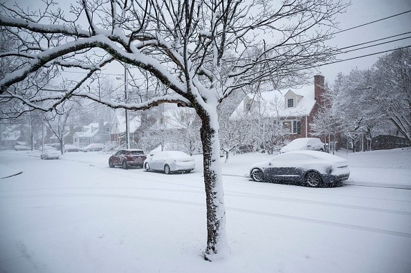
After a storm that brought heavy snow, a wintry mix, and torrential rain, the central Mississippi Valley and the Midwest saw a temperature drop and freeze-up of comparable severity.
According to AccuWeather Senior Meteorologist Brett Anderson, this will serve as a stark reminder of how bad January can be even after mild weather blanketed most of the Midwest in December.
Standing water and slush will freeze when the storm passes through Chicago and the Central Plains and Great Lakes region.
Ice, Snow May Disrupt Movements
According to weather experts, if snow is not removed and treated as soon as possible, ice may develop on the roads and properties, which will be exceedingly difficult to remove.
Drivers from regions of Kansas, Nebraska, and northern Ohio returning to work and school on Monday am are advised to be prepared to encounter stretches of ice and hard-packed snow.
This weekend, colder air is expected to settle over many of the regions targeted by severe weather, and a weak following storm may possibly deliver a little snow to portions of Tennessee and Kentucky on Sunday.
Arctic air will be relieved from sections of the northern Plains by the warmer Pacific air predicted to surge eastward by midweek, but the cold air may be more hesitant to depart the Midwest and the South Central states farther east.
Related Article : More Than 100 Million US Residents Under Cold Weather Warnings as a Result of Low Temperatures
For more news, updates about cold weather and similar topics don't forget to follow Nature World News!
© 2026 NatureWorldNews.com All rights reserved. Do not reproduce without permission.


