According to the National Weather Service, more than 100 million US residents have been left under cold weather warnings, freeze or frost alerts.
First Freezing Temperatures of the Season
Low temperatures have swept across a number of major cities, delivering the season's first frosts and wind chills.
The temperature drop hasn't broken any records, but they are at least 15° colder than usual throughout the East Coast - despite warmer-than-normal weather in the country's western half.
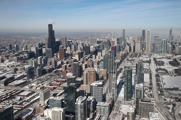
According to the weather service, the week in Chicago has been distinguished by sub-freezing morning temperatures. Temperatures will barely hit 49 ° on Thursday, but steady rising is forecast through Sunday.
Forecasters observed the first snowflakes of the season at Chicago Rockford International Airport, but they are not anticipated to evolve into a storm.
Temperatures in New York's tri-state region dropped below 33 degrees overnight, technically terminating the growth season for the year, according to the meteorological service. Frost or freeze warnings were issued for Orange County, New Jersey, and sections of Connecticut.
Temperatures are expected to hit 29° by Friday night in Nashville, where frost first arrived on Tuesday. The meteorological service reported near-freezing temperatures in the Baltimore and Washington, D.C. areas this week, with temperatures hovering 10 degrees below normal. Lows of 25° were recorded in certain parts of Virginia.
Cold Weather to Continue Over the Weekend
The frigid temperatures come after a record-breaking summer in most major cities, with over 200 million Americans under heat warnings in August.
According to the National Oceanic and Atmospheric Administration, 18℅ of the nation suffered hazardous and record-breaking heat this summer, with California, Idaho, Nevada, Oregon, and Utah experiencing their warmest summers ever.
Massive temperature extremes, according to climate scientists, are a direct effect of global climate change. President Joe Biden committed to collaborate with other countries to reduce methane emissions by 30℅ by 2030 at the United Nations climate conference in Glasgow, Scotland, on Monday.
November began substantially colder than October, and there was anticipation that the cold would continue over the weekend before returning to more typical levels early next week. As the clouds dissipate, radiational cooling will take over, and temperatures will plummet into the low to mid 30s.
Potential Costal Flooding in Eastern North Carolina
High pressure will once again govern weather tomorrow to the north. To the south, the Gulf Coast system will attempt to get more structured. The low will remain east of Florida at the start of Saturday, and will only slowly move north-northeast over the day, according to the models.
Showers will travel up the coast by the end of the day, but rain will remain to the east to begin the weekend.
Morning weather models today are bringing this storm a bit farther north and west than originally forecast, so rain is added to the forecast for later Saturday and Saturday night in the viewing region.
As the storm moves slowly northeast, the key window of worry seems to be Saturday night into Sunday morning. The most serious threats for eastern North Carolina will include locally heavy rainfall and gusty gusts, as well as the possibility of severe surf and coastal flooding, particularly during high tides.
A weak front will pass to the north on Wednesday, but it may never arrive, and high pressure will remain in charge until at least Thursday.
Related Article : Rare Phenomenon: For the First Time in 64 Years, Streets in Brazil Are Covered in Snow!
For more news, updates about cold weather and similar topics don't forget to follow Nature World News!
© 2026 NatureWorldNews.com All rights reserved. Do not reproduce without permission.


