Cold air from Canada is fueling a storm system headed for the Great Lakes. For many, this will make post-Christmas travel dangerous, but will Chicago's snowless run come to an end this time?
Snow Drought in Chicago
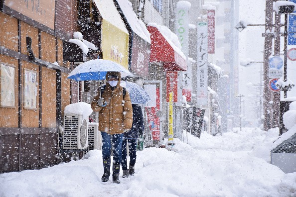
Chicagoans hoping for snow by new year may be disappointed.
Forecasters predict that the 290-day record set in 2012 will be shattered before the year 2022 even begins, rewriting the city's record for its longest snowless run.
It's been 286 days since Chicago has seen any significant snowfall, according to the National Weather Service.
However, so far this season, there have been just a few flakes seen in the region. This year has already surpassed last year's record for the latest date without detectable snowfall, which was established on Dec. 20, 2012.
A snowstorm is considered measurable if it results in an accumulation of at least 0.1 inch of snow, according to Accuweather.
Looking forward, despite the introduction of a stormy weather system in the area, persistent warmth will continue to dampen any snowfall aspirations.
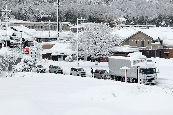
There will be rain and snow across the Midwest and southern Canada until the middle of this week, according to forecasts. North Dakota, Minnesota, Wisconsin, and Michigan are among the states that are expected to be hit hardest by the winter weather early this week.
Cities to Experience Accumulating Snowfall
On Sunday evening, the first storm moved into the Dakotas, and it will continue to move east over Lake Superior through Monday.
Cities including Green Bay, Wisconsin; Minneapolis, Minnesota; and Fargo, North Dakota; are predicted to see accumulations of snowfall until early Monday morning. When it comes to post-Christmas travel, the roadways might be icy.
However, the weather in Chicago may not be chilly enough to put an end to the city's snowless run.
On Monday morning, the Windy City is anticipated to have a low temperature of roughly 40 degrees Fahrenheit.
As of Wednesday, the weather in Chicago will begin to drop down and return to more typical December temperatures. For the rest of the week, temperatures are predicted to remain below freezing.
How Often Does Chicago Witness a White Christmas?
A typical first snowfall in Chicago often occurs around Halloween. The city's first measurable snowfall is typically reported by Nov. 18, while the usual first 1-inch snowfall happens by Dec. 7 on average.
Winter Christmases don't happen very frequently in the metropolis. These probabilities hover between 50 and 60 percent on an annual basis. The National Weather Service defines a white Christmas as one with at least one inch of snow on the ground when Santa Claus arrives on Christmas morning.
Due to the moderate weather, Chicago's prospects of seeing a white Christmas have diminished this year.
Prior to Christmas Eve on the 24th of last year, the Chicago O'Hare International Airport recorded a 0.2-inch snowfall. The daytime high was a brisk 22 degrees Fahrenheit, while the nighttime low was just 8 degrees.
This year, forecasts predict a high of 46 degrees Fahrenheit and a nighttime low of 30 degrees Fahrenheit.
According to AccuWeather Lead Long-Range Meteorologist Paul Pastelok, the present weather pattern is being impacted by a weather phenomena called La Nia. However, the city's snow drought is expected to last into the new year, given the forecast's generally mild and above-average temperatures.
Related Article : Record Breaking Low Temperatures Continues as Snow Continues to Pile Up Across the West
For more news, updates about snow and similar topics don't forget to follow Nature World News!
© 2026 NatureWorldNews.com All rights reserved. Do not reproduce without permission.


