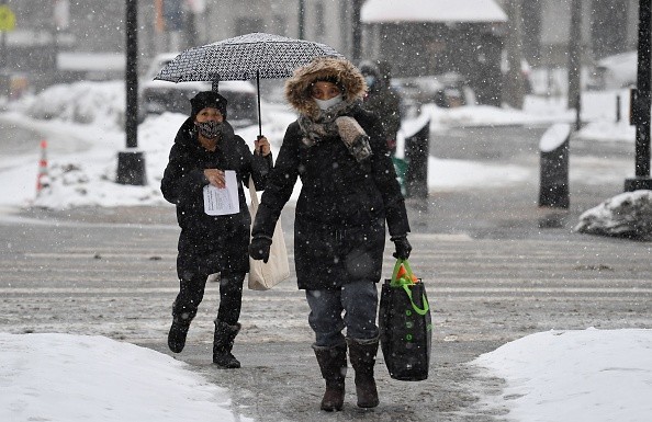
Many forecasts model runs used by meteorologists to help in predicting show that Thanksgiving Week might start on a chilly note, with a snowfall forming in the northeast. However, because November is a month of major weather transition, with milder autumn circumstances giving way to colder winter conditions, one shouldn't place too much faith in forecast information this far out.

"Weather models periodically produce systems that appear pretty scary a week or two away, but they never materialize," National Weather Service meteorologists in Aberdeen, South Dakota, say today. "Subsequent runs reveal weakening or shifts, while other models may have nothing at all."
Forecasts

While meteorologists have several tools to make, weather forecasts, the ECMWF from Europe and the GFS from the United States are two of the most commonly used global forecast models. While the models use many of the same beginning material, how they digest it and calculate alternative outcomes differs. In certain cases, one is superior to the other, but the opposite is true in others. As a result, no model is always "correct." Aside from the ECMWF and GFS models, various more models from different nations, academic organizations, and commercial businesses are also considered when formulating forecasts.
Last night, the American GFS prediction model predicted that a trough of low pressure would form along the Mid Atlantic, becoming a powerful trough as it moved northeast. Snow would fall from Pennsylvania and New Jersey to Maine and New Hampshire if that computer model run were to come true, with some major accumulations likely over New England.
However, the same model has forecast a different scenario today afternoon, which would bring substantial snow to northern New England but nothing else to the south. If this model run is accurate, portions of the Mid Atlantic, particularly the south, may even remain dry.
Related Article : Winter May Start with a Bang in the Eastern Plains as a Blizzard Forms
Keeping Watch
Early next week, forecast models predict a weaker, lighter, wintry weather storm moving over parts of the Great Lakes and Northeast. While not as substantial as some model runs expect for the days coming up to Thanksgiving, it is still necessary to watch that system.
Nothing else can be done but wait until forecasters have a clearer understanding of how these storm systems will unfold in the following days and weeks.
Snowstorms and Blizzards
A snowstorm is a storm in which the precipitation falls as snow. Because the temperatures at the top of the storm are low enough to generate snowflakes, most rain falls as snow among the clouds in the winter. Snowflakes are formed when water vapor condenses into droplets and freezes, resulting in a cluster of ice crystals. As they fall to the ground, these ice crystals stick together, forming snowflakes. The precipitation will fall as snow if the air temperature between the cloud and the environment remains at or below 0°C. Conversely, the precipitation will melt into the rain or freezing rain if the air temperature near the ground is above freezing.
Blizzards are extreme snowstorms distinguished by the force of the winds rather than the amount of snow they produce. Blizzards cause blowing snow conditions, in which snow on the ground is scooped up by the wind, creating reduced visibility and the building of snowdrifts when wind speeds reach or exceed 35 mph. A blizzard lasts three or more hours and frequently results in large amounts of snow accumulation, either from new precipitation or through the redistribution of previously fallen snow as blowing snow.
For more news the environment, don't forget to follow Nature World News!
© 2026 NatureWorldNews.com All rights reserved. Do not reproduce without permission.


