According to AccuWeather experts, Mother Nature may add to the developing winter vibe by bringing her dose of wintery conditions to the northern and eastern parts of the country starting late this week.
While analysts predict a wintry surge during the first half of the week, it may not seem like winter is on the way. Temperatures as far north as Fargo, North Dakota, soared beyond 60 degrees Fahrenheit this past weekend. Fargo's average high temperature for this time of year is in the lower 40s.
Temperatures in the South

Temperatures in the 70s were recorded further south, with some areas reaching 80 degrees. This week's warming will extend eastward from mid-November. Highs in the 60s and 70s will be widespread over the Ohio Valley and the mid-Atlantic by Tuesday. On the other hand, Forecasters suggest enjoying it while it lasts, since dramatic changes are coming in the second part of the week.
It all starts on Tuesday when a storm bringing more heavy rain and mountain snow to California moves inland throughout the West. The energy from this system will emerge in the Plains by Wednesday, and a massive storm will begin to form across the Plains. While the storm's colossal size may result in heavy thunderstorms further south, a considerably more wintry sight is expected to emerge to the north.
Related Article : 1st Major Winter Storm of the Season May Arrive Next Week
Cold Blasts in the East
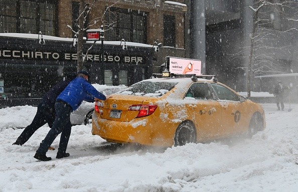
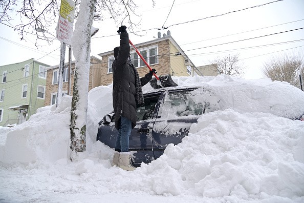
There are still a few possibilities that may play out throughout the northern Plains and upper Midwest on Wednesday and beyond, but forecasters are getting more confident in a blast of cold and windy weather with at least some snow in the second part of the week. Forecasters also warn that a full-fledged snowstorm is still possible for sections of the Plains.
"One option is for the storm to race over the northern Great Lakes into Canada, leaving less snow in its wake in the northern Plains and directing it farther north into Canada," Meteorologist Jessica Storm noted.
On the other hand, the storm describes a second possibility in which the storm might stall in the upper Midwest, dumping protracted and often heavy snow on the northern Plains and upper Midwest. Again, Fargo, North Dakota, Sioux Falls, South Dakota, and even Minneapolis are included.
Strong Winds
Strong winds will develop around the storm, assisting in the movement of colder air southward from Canada and causing blowing and drifting when snow does fall. Wind gusts of 40-50 mph can generate significant blowing snow and perhaps blizzard conditions even when minimal snow accumulations.
"These powerful gusts, along with a foot or more of snow, could produce major disruptions in places that bear the brunt of the storm," the storm added. Forecasters say that wherever this happens, travel will likely be disrupted for some time. This could affect portions of major highways in the United States, such as I-90, I-94, and I-25, and portions of the Trans-Canada Highway, which runs along the north shore of Lake Superior to around Winnipeg, Manitoba.
Even if the storm in the Plains dissipates by the weekend, the wintry weather will continue to advance. As a wave of cold air moves eastward, lake-effect snow is anticipated to develop by the end of the week. Rain and snow showers are also possible in the Ohio Valley.
Reaching the Southeast
The frost will reach the Southeast even if the snow does not. On at least one day next weekend, even places along the Gulf Coast like New Orleans, Mobile, Alabama, and Tallahassee, Florida, may struggle to get out of the 50s. Across a significant section of the Southeast, widespread frosts and even freezes are possible.
The cold will continue to make its way up the East Coast, and another storm along the coast, perhaps bringing the first snow of the season to parts of the Northeast and mid-Atlantic, might form by the end of the weekend or early the following week.
"By next weekend, a cold front will likely reach the East Coast and maybe stall as low pressure forms and advances north along the front," Lead Long-Range Meteorologist Paul Pastelok said.
"This will bring considerably colder air behind the storm on the East Coast, with interior areas of the Northeast, Great Lakes, Ohio Valley, and the Appalachians possibly changing from rain to snow," Pastelok wrote.
According to experts, people seeking to put up holiday lights around the house or finish other exterior winter preparations should do it while the warmer weather over the next few days, before the winter invasion begins.
For more news the environment, don't forget to follow Nature World News!
© 2026 NatureWorldNews.com All rights reserved. Do not reproduce without permission.


