This incoming storm will bring less precipitation, unlike the significant bomb cyclone that hit California late October.
Drought-stricken State Experiences Rain and Snow From the Storm
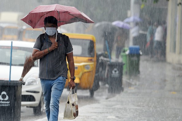
A few weeks after an atmospheric river delivered significant rain and snow on portions of California, a Pacific storm train dumped more rain and snow on the drought-stricken state. But this time it was less intense.
Unlike the record storm that hit California a few weeks ago, which dumped about 6 inches of rain in Sacramento and over a foot in some places in the Sierra foothills, this storm will be less powerful but still substantial.
Throughout the San Francisco Bay Area, 0.50 inch to 1.00 inch of rain fell. The greatest rain fell in San Francisco overnight Monday, but showers may continue through Tuesday morning, causing traffic delays.
The Sacramento Valley, including Sacramento, is forecast to get 0.50 to 1.00 inches of rain from the storm, compared to 5.41 inches on Oct. 24.
Localized flash floods and mudslides, particularly in burn scar regions, will still be possible, although not as extensive as during the previous storm. Northern California will see floods from small streams and inadequate drainage.
Officials Issued Wind Advisories Across Coastal Region
Strong winds slammed California, Washington, and Oregon coasts. Wind gusts of 30 to 50 mph hit the Bay Area late Monday night, prompting wind advisories. Wind gusts of up to 60 mph were recorded in northern California and southern Oregon. As the storm passes inland, the winds reduced.
The storm's final rainfall totals will be lower further south. Up to 0.50 inch of rain is forecast on the west-facing slopes of the Central Coast Ranges in California through Tuesday, while totals in the San Joaquin Valley will likely stay below 0.50 inch, and in Fresno, 0.10 to 0.20 inch is expected.
This storm will bring little or no rain to Southern California.
In October, Los Angeles got 0.71 inches of rain, 0.49 inches of which came during a significant storm close to the end of the month. But it hasn't rained since. In Los Angeles, however, little rain in November is usual, with 0.78 inch of rain falling on average.
The U.S. Drought Monitor says that despite significant rains in Northern California last month, the area is still under severe or exceptional drought. While AccuWeather meteorologists say this storm will deliver more rain and assist shift the water tables in the correct direction, there's still a long way to go to ease drought worries.

California to See Rain-free Weather After the Storm
Heavy snow will fall in the Mountains again, while snow levels will stay high in California. AccuWeather Meteorologist Nicole LoBiondo said accumulations will be 6-12 inches above snow levels, with some locations reaching 2 feet.
LoBiondo warned that places receiving up to 2 feet of snow are expected to be far above the snow line, maybe at 8,000 or 9,000 feet.
The snow level in Washington and Oregon will be 3,000 or 4,000 feet. On Tuesday, a few inches of snow may fall in Snoqualmie Pass, causing slick conditions on Snowfall and road difficulties are more expected in the higher Stevens Pass, east of Seattle.
After Tuesday when the storm moves on, forecaster reveal that California will be rain-free. The stormy pattern should return by Wednesday night. Another atmospheric river may target the Washington Cascades on Thursday and Friday, bringing the potential for substantial damage.
Related Article : Meteorologist: Storm Surge Anticipated Along Florida West, South Coasts
For more news, updates about storms and similar topics don't forget to follow Nature World News!
© 2026 NatureWorldNews.com All rights reserved. Do not reproduce without permission.


