A severe storm over the Gulf of Mexico packs up gusty winds and flood risks across much of Florida and the Southeast this Friday evening, AccuWeather reports.
Florida rain is expected to soak up regions which are typically dry in this month of the year, while threats of coastal hazards were issued to the Southeast as the storm develops, with potential to become a tropical storm.
Cold air sets ahead in the Southeast pressing southward, colliding with warm and humid over the Florida Peninsula, and setting up a front along the Gulf and Atlantic coastline.
As this front creates path for drenching storm, much of Texas will experience heavy rain and local flooding on Wednesday, associated with a general 0.50-1.50 inches of rain from Fort Worth on south in the Lone Star State.
Several areas just north and west of Brownsville, Texas had picked up around 3 inches of rain as well.
Flooding becomes primary concern
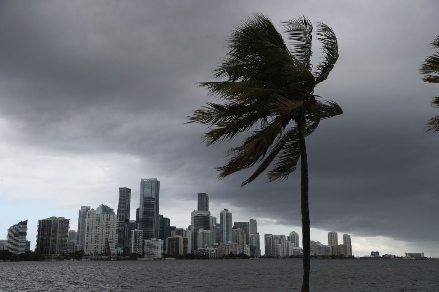
Risks of localized flooding is high as rain and thunderstorms reach the Florida Peninsula and more torrential downpours spread across much of the Sunshine State. Thunderstorms could potentially become more severe on the southern portions by Friday afternoon, while Florida peninsula may garner damaging winds and isolated tornadoes in the evening.
AccuWeather estimates 70 mph of gusty winds during this period.
"As this moist air clashes with a stalled front over the Southeast, the result will be a period of heavy rainfall, especially from central Florida to northeastern Florida, including Tampa, Orlando and Jacksonville, Friday through Friday night where pockets of urban and flash flooding will impact residents in the region," said AccuWeather Senior Meteorologist Brett Anderson.
In the meantime, outdoor events shall be postponed to prevent lightning strikes, drivers are warned for reduced visibility on roads, and swimming in the beaches is not advised.
Severe storm warnings
"There is a small chance this evolving storm system could acquire some tropical characteristics Sunday or Monday of next week as it moves over relatively warm water and becomes detached from the frontal boundary," AccuWeather Senior Meteorologist Dan Pydynowski said. "If this were to happen, it could be classified as a subtropical storm for a brief period of time."
The National Weather Service office in Miami, Florida, issued severe thunderstorm warnings across 4 counties on Friday morning, along with a special marine warning in cases of waterspouts as winds pick up across the region.
"November is the driest month of the year in a large part of Florida, and rainfall amounts from this storm could reach, and even double, average monthly November levels," said AccuWeather Senior Meteorologist Dave Houk.
Impacts in coastal areas primarily target the east-facing coasts from Florida to the Outer Banks in North Carolina, while king tides are expected at the end of this week along the Southeast coast.
Flooding could aggravate along Carolina coasts as well especially at high tide. Rain is expected to head east of the Outer Banks late Sunday.
© 2026 NatureWorldNews.com All rights reserved. Do not reproduce without permission.


