During the first week of November, meteorologists are keeping an eye on the possibility of a pattern shift that would bring the coldest air of the season to sections of the central and eastern United States.
In addition, the combination of approaching cold air and storm formation may get the first flurries or possibly substantial snow of the season to regions of the Midwest and Appalachians next week.
"Could it be that we're talking about snow in the Midwest and Northeast?" On Thursday, Chief On-Air Meteorologist Bernie Rayno raised the question on his Weather Insider podcast. "Maybe."
This weekend, cold air from northern Canada will arrive, and it will expand through most of the north-central United States next week.
Expected to be Colder
The air is expected to become much colder next week from the Appalachian spine to the Midwest. As storms develop and ride along the leading edge of colder air, the breadth of the cold air will dictate where snow may fall, maybe many times.
"It won't be Arctic air or record-breaking cold that sweeps in," Rayno continued, "but it will be a shift and chilly enough for snow if the rounds of precipitation expected are persistent and heavy enough."
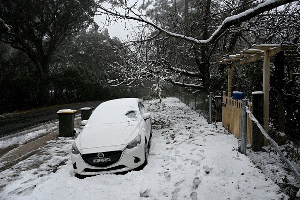
The coldest air of the season will settle in in the Midwest, and it may persist longer than previous cold spells this October. Over a large portion of the North Central states, highs are predicted to drop into the 30s and 40s F on several days next week, with nightly lows ranging from a few degrees below freezing to as low as the 20s.
Related Article : At Least 30 Million People are in Danger Due to Extreme Weather Outbreak
Storm Track
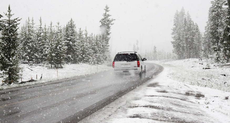
A vigorous storm track will form from the central and southern Plains to the Ohio and Tennessee valleys, and eventually the central and northern Appalachians, around the same time next week.
Because cold air tends to congregate on the northern and western sides of storms, pinpointing the exact location of the storm track will be crucial in identifying where snow will fall.
According to analysts, two major storms will be monitored as potential snow concerns next week. However, each storm was still over the Pacific on Thursday, so the exact time of both is unknown.
Two Storms
The first of the two storms is expected to move from the Midwest to the Northeast at midweek. Because this smaller storm won't have much cold air to work with, any precipitation it produces will be minimal. Instead, this storm might bring chilly rain showers, rain mixed with wet snow, or rain followed by wet snow throughout a corridor stretching from Nebraska and northern Kansas and Missouri to West Virginia, northern and western Pennsylvania, and northern New England.
The second and more powerful storms are expected to form later this week into next weekend. This storm has a stronger possibility of generating more cold precipitation in the form of rain, a rain/snow mix, or a period of accumulating wet snow since it may have more cold air entrenched.
Cold Air
It's conceivable that the cold air may spread south into places like the mid-Atlantic, but Rayno believes that the border dividing chilly air to the north and warmer air to the south will form a little further to the north.
For example, peak temperatures in New York City are expected to drop from the lower 60s this weekend to the middle 50s next week, with nightly lows in the 40s, far above the snow line.
Snowfall along and east of Interstate 95 from the mid-Atlantic to New England is unlikely to occur next week or next weekend, at least at this time. The most likely location for accumulating snow or flurries, according to Rayno, will be over the Appalachians and west to Ohio.
There's the status of the foliage to consider if the late-week storm turns into a big wet snow producer for areas of the Appalachians and Midwest. Trees with leaves remaining on them will be more prone to toppling under the weight of snow, causing power lines to be downed.
Reinforcing waves of cold air are expected to blast the Great Lakes region in the aftermath of storms, particularly the potentially larger storm expected at the end of next week. In addition, lake-effect snowfall is anticipated to develop over locations downwind of the Great Lakes when cold air moves over the warm water. For example, as of late October, the water temperature in Lake Erie near Buffalo, New York, was 60.4 degrees Fahrenheit.
Autumn Predictions
In the autumn prediction, which was posted in early August, long-range forecasters initially cautioned of the possibility of an early-season blizzard and lake-effect snowfall.
According to Long-Range Lead Meteorologist Paul Pastelok, the pattern is amplified, as evidenced by recent bomb cyclones that have impacted the United States over the past week, and a pattern shift from unseasonably warm to an early-winter chill from late October to early November should set the stage for snowfall. The chilly air alone will make it feel like an early winter trend by the middle to end of next week.
For more news about making the environment sustainable, don't forget to follow Nature World News!
© 2026 NatureWorldNews.com All rights reserved. Do not reproduce without permission.


