A record-breaking bomb cyclone that wreaked havoc in the Western states over the weekend is still wreaking damage as it moves across the country. Severe weather could explode over a dozen states over three days as the storm moves eastward across the central and southern United States, putting nearly 30 million people in danger.

Tornadoes Everywhere
More than a dozen tornadoes were recorded in three Central states on Sunday night, prompting the latest round of extreme weather. One of the hardest-hit regions was more than 80 miles south of St. Louis, in Fredericktown, Missouri, when an EF3 tornado struck.
Experts believe the October record for the number of tornadoes in the United States will be challenged with the intense storms created this month and the dynamic pattern emerging.
The storm system is projected to grow through midweek after weakening a little while negotiating the Rocky Mountains on Monday night, laying the stage for possibly catastrophic thunderstorms.
Tornadoes are a possible hazard from severe weather, and some of them can strike well after dark, heightening the danger element. Even if only a few tornadoes impact, powerful wind gusts of 40-60 mph are expected through Thursday evening, with 80 mph. Winds of that size have the potential to cause harm.
Related Article : NWS Raises Alarm as Severe Storm Rapidly Develops in the East Coast
Strong Winds
Strong gusts and hail accompanied severe thunderstorms from central Kansas through Texas' hill region late Tuesday into early Tuesday night.
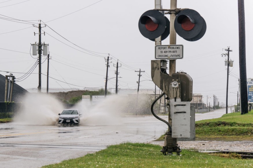
Strong wind gusts, torrential rain, and flash floods will be the major risks from the storms as they travel eastward and consolidate into a solid line from central and eastern Nebraska to central Texas later Tuesday night, according to AccuWeather Meteorologist Joseph Bauer. Topeka and Wichita, Kansas, are two cities that late-night storms might badly strike.
Around sunrise Wednesday morning, a line of storms with heavy rain and locally severe gusts will continue to move southeast, passing into eastern Oklahoma and Texas. The storms may be highly disruptive for part of the morning commute in Tulsa, Oklahoma, and Dallas, Fort Worth, Waco, College Station, Tyler, and Austin, Texas.
During the day Wednesday, severe weather chances will persist and continue to trend eastward across parts of the South Central states and along the Gulf Coast. According to Bauer, an additional component will be added to the ones that contribute cause severe weather. Former Hurricane Rick, which made landfall in Mexico as a Category 2 storm earlier this week, will also be a factor.
Worsening Weather Conditions
-On Wednesday, the chance of storms bringing heavy rain, high gusts, and isolated tornadoes will stretch from southern Arkansas to parts of the Texas coast and eastward over Louisiana.
Houston and Port Arthur in Texas and New Orleans, Lake Charles, and Monroe in Louisiana are all in danger of severe thunderstorms and flash floods on Wednesday.
Because there is still enough warm and humid air accessible from the Gulf of Mexico, severe weather is not uncommon in the southern United States in the autumn. At the same time, as frigid air from Canada pushes into the country, a strong jet stream across the northern tier may dip southward on occasion. The colliding air masses provide an ideal environment for strong thunderstorms to form.
"There is a higher probability of severe weather in the eastern Red River Valley into the lower Mississippi Valley from the last week of October into early November, which is almost exactly where damaging and dangerous storms are likely to occur into Wednesday," Meteorologist Joseph Bauer said.
According to Meteorologist Mary Gilbert, the number of tornadoes this month has set a new record, and heavy thunderstorms expected this week might push October 2021 to the top place for twisters.
Extreme Weather

To break the record, six additional tornadoes would have to strike down, and considering the forecast for Thursday, this is certainly within reach. The Storm Prediction Center has collected 118 preliminary tornado reports this month as of Tuesday morning. Only a few years ago, in 2018, a new October record of 123 tornadoes was set.
There is the potential for considerable loss of life and destruction if a single tornado strikes a populated area or crosses a highway. So forecasters advise folks in the line of severe weather to have a method to get weather bulletins before going to bed or while driving.
High gusts of 70 mph are forecast to scream over the eastern slope of the Rockies to the central and southern Plains Wednesday and Thursday due to the severe weather.
For more news about making the environment sustainable, don't forget to follow Nature World News!
© 2026 NatureWorldNews.com All rights reserved. Do not reproduce without permission.


