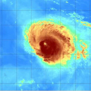
Newly formed Hurricane Rick has churned up in the warm tropical seas of the eastern Pacific Ocean, putting Mexico's southwestern Pacific coast on high alert over the weekend.
On Friday morning, Tropical Depression 17-E developed 500 miles south-southeast of Manzanillo, Mexico, breaking an eight-day calm in tropical activity in the eastern Pacific. By Friday afternoon, the spinning mass of showers and thunderstorms had grown even further, forming Tropical Storm Rick, the 17th named storm of the East Pacific season.
Hurricane Rick continued to build fast, and by Saturday AM, it had become the East Pacific season's ninth hurricane.
Making Landfall
Rick made landfall on the southern Mexican coast about 5 a.m. CDT Monday, some 15 miles (25 km) east of Lazaro Cardenas. Rick had sustained winds of 105 miles per hour (165 kilometers per hour) and was classified as a Category 2 hurricane by the Saffir-Simpson Hurricane Wind Scale.
Hurricane Pamela, which made landfall on Oct. 13 between Matzalan and La Paz in the coastal state of Sinaloa, was the most recent hurricane to hit Mexico. Pamela then sped northeast into the rugged terrain, bringing with her heavy rain and strong gusts. Although Pamela lost its tropical characteristics before crossing the Texas border, the former storm's force was still enough to cause floods and many tornadoes in Texas.
Rick might find itself in a similar situation since he is anticipated to go north through Mexico.
Related Article : Warnings Raised as Extreme Atmospheric River Ravaged Pacific Northwest, Wreaking Havoc on its Path
Gaining Strength
Rick was able to intensify while approaching the land due to excellent conditions in this part of the eastern Pacific. However, as the hurricane advances interior, an increasing amount of contact with steep terrain should weaken the hurricane.
Because Rick made landfall further south along the coast on Monday, Sinaloa will be spared the worst of the storm's effects. However, as gusty winds and swirling rainbands sweep ashore throughout the day, several communities in the Mexican states of Jalisco, Colima, Michoacán, and even Guerrero must stay on high alert.
As the storm intensifies overhead, residents and tourists in cities along Mexico's Carretera Pacfico Highway from Acapulco to La Manzanilla must be aware and watchful. Even when Rick moves onshore on Monday, anticipate damaging wind gusts, flooding rains, and enormous swells.
Worsening Conditions
As the outer bands raked the shore late Saturday and early Sunday, conditions began to deteriorate. During the same period, more windy conditions began to emerge.
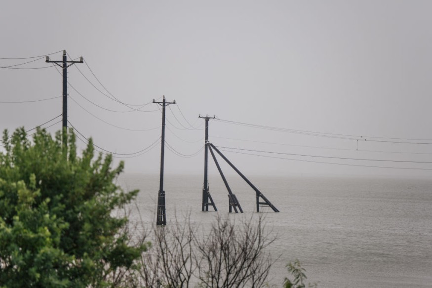
Rick's heavy rain will follow along Mexico's Pacific coast and into the rugged mountainous terrain, regardless of any drop of wind intensity due to contact with land.
"Heavy rains of 8-12 inches (200-300 mm) with an AccuWeather Local StormMaxTM of 20 inches (500 mm) could cause extensive flooding and mudslides over the region beginning Sunday and extending through early next week," said Senior Meteorologist Rob Miller.
At landfall, strong wind gusts will likely damage the structural integrity of structures near Rick's core. Additionally, near and just east of the landfalling hurricane, damaging wind gusts of 100-120 mph are likely.
AccuWeather Scale
Rick will be a two on the AccuWeather RealImpactTM Scale for Hurricanes due to the possibility of destructive wind gusts, flooding rainfall, storm surge, and economic effects.
Rick is expected to move northward through central and northern Mexico after making landfall on Monday. Rick's low-level circulation will be shredded by the rough terrain, leading to a quick reduction in wind intensity. Rain will continue to pour, posing a risk of flooding in Guadalajara, León, and the neighboring areas Monday night and Tuesday.
After passing over the hilly terrain of central and northern Mexico, the residual upper-level energy connected with Rick may continue to climb northward by midweek. So while there is still time to watch the storm's progress and trajectory, people in Texas and around the Gulf Coast should keep a lookout for rain.
For more news about making the environment sustainable, don't forget to follow Nature World News!
© 2026 NatureWorldNews.com All rights reserved. Do not reproduce without permission.


