Although the Atlantic hurricane season doesn't technically finish until November 30, experts say the chances of another tropical storm forming shortly are slim. There is currently just one name remaining on the list of storm names for 2021, after a hectic pace during hurricane season's peak. Wanda. Is it possible that that name will go unnoticed?

2021 Atlantic Hurricane Season
The 2021 Atlantic hurricane season got off to a record-breaking start on July 1, with five storms developing within the first day, breaking a previous record established just a year before. After that, the season went on at a breakneck speed, with development starting in mid-August and lasting until mid-September. Eight hurricanes made landfall in the United States by the conclusion of the era of high activity. The tropics, on the other hand, are currently inactive.
"We're heading into a period when fewer tropical features are coming off Africa, which is generally the instigators of tropical storms and hurricanes before October," said Hurricane Expert Dan Kottlowski.
Strong Tropical Development
During hurricane season, tropical waves that form off the coast of Africa are generally the genesis of tropical storm development. According to Kottlowski, tropical waves are responsible for 85 percent of all tropical storm formations.
Hurricane Ida

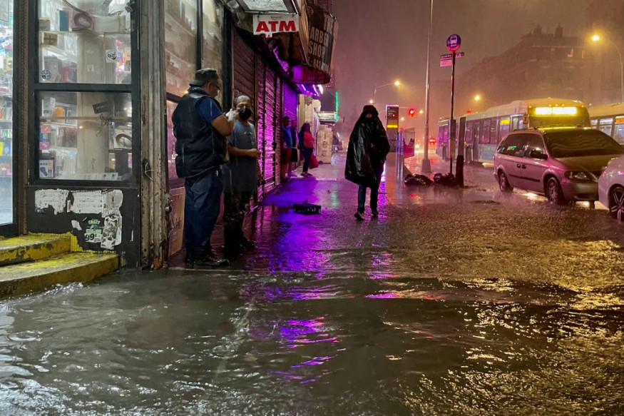
Hurricane Ida, the most powerful hurricane to hit the United States this year, sprang from a tropical wave that formed off the coast of South America in the southern Caribbean Sea. Before making landfall in Louisiana, Hurricane Ida strengthened quickly. Even after losing its wind strength, the storm continued to wreak havoc in the Northeast as a tropical downpour.
Hurricane Henri developed off the coast of the United States and had a unique genesis in a series of thunderstorms that traveled across the country for over two weeks before making landfall in Rhode Island.
However, tropical waves generally drop around October, with storms originating in the Caribbean Sea.
Hurricane Nicholas
Hurricane Nicholas, which developed in September this year, formed in the Bay of Campeche before making landfall as a Category 1 hurricane in Texas, following a pattern more typical of October tropical formation.
Wind Shear
Wind shear over the Caribbean Sea, on the other hand, is substantially reducing the likelihood of any further tropical development this year.
"Strong winds, also known as wind shear, weaken tropical storms, which is why it's been so quiet since September 15, since we've had a huge amount of wind shear in the Atlantic basin," said AccuWeather Chief Broadcast Meteorologist Bernie Rayno.
The shift in direction and speed of winds at increasing heights in the sky is known as vertical wind shear, and it has the greatest influence on tropical systems.
The top of a tropical storm or hurricane can be thrown hundreds of miles downstream when severe vertical wind shear exists. As dry air enters the system or the flow of warm, moist air throughout the entire storm is disturbed, the storm can become highly unbalanced or slanted and begin to unravel. Strong wind shear can prevent a storm from developing.
La Niña
"We're entering a La Niña," Kottlowski added, referring to the climatological phenomena in which sea surface temperatures in the equatorial Pacific Ocean fall below average, affecting weather throughout the world. "And typically when you go into a La Niña, that favors keeping the vertical wind shear to the north, and that's not happening right now," he added. "The vertical wind shear has been deep into the tropics over the last several days, and that's the reason we haven't seen robust patterns to create the opportunity for tropical development."
According to NOAA, the La Niña phase has officially been established, and meteorologists predict it will last through spring of next year.
Wind shear may be seen on satellite images by attentive viewers. For example, high levels of wind shear are likely to blame if an active tropical cyclone seems lopsided, with clouds on only one side of the system. In addition, wind shear may be seen on water vapor satellite loops, which show the flow of water vapor in the upper atmosphere, and therefore can suggest strong winds in the absence of a tropical storm.
However, as Kottlowski stated, a La Niña phase influences the weather pattern over the Atlantic basin, which historically has shifted vertical wind shear northward and out of the Caribbean.
Few More Additional Storms

If La Niña aids in improving conditions, the Atlantic basin may be able to produce a few additional storms before the season finishes or perhaps after the season officially concludes on November 30. Storms can arise as late as January, and storms have developed as late as November.
For more news about making the environment sustainable, don't forget to follow Nature World News!
© 2026 NatureWorldNews.com All rights reserved. Do not reproduce without permission.


