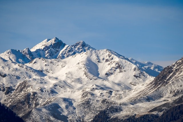
A powerful, winter-like storm is expected to sweep through the Rockies next week, bringing broad accumulating snowfall that will be a pleasant sight for snow enthusiasts and benefit ski resorts early in the season. Instead of inches, snowfall totals might be reported in feet.
Some of the greatest snowfall accumulations are predicted in Wyoming's Interstate 25 and U.S. Highway 26 corridors, with 1-2 feet of snow.
Increasing Snow
As increasing snow and temperatures cold enough to fire up the snow machines are forecasts, it may develop into a contest to see which of Colorado's ski resorts can open for the ski season first. Arapahoe Basin, Loveland, and Keystone Ski Resorts have been among the earliest to open to the public in recent years, and this might be the case again this year.
Before the arrival of the major storm system, there will be bad weather to contend with across the West. However, mother Nature appears to have turned a switch in the West, as portions of the region went from bone-dry for an extended period to being hit by numerous storms in less than a week.
Forecasted Fall
Rain and mountain snow is expected to fall daily over the West until the middle of next week. On Friday morning, Las Vegas and Fresno, California, received their first measurable rainfall since September 12. The rain on Friday was the first measurable rain in Fresno since April 25, extending the dry spell that began in the spring.
On Saturday, the unstable weather will move into the central Rockies, bringing with it more clouds than sunlight and the possibility of showers in cities like Salt Lake City and Grand Junction, Colorado. The absence of cold air in place should keep snow levels far above the tree line on most summits in these locations, but where leaves haven't yet fallen, a stunning contrast between the snow-covered mountain tops and the yellow aspen trees is conceivable.
Conditions in the Rockies
Conditions will quiet down over the Rockies during the day on Sunday, except for a few lingering showers in southern Colorado and northern New Mexico, as the region will be primarily in-between storms. Unfortunately, the calm weather will not stay long, as the next storm to hit the western U.S. will make landfall in the Pacific Northwest early next week.
Early next week, snow levels will likely be at their lowest of the season, posing a problem for motorists on mountain pass roads. As a result, Monday's most challenging travel areas will most likely be Idaho, southwestern Montana, and northwest Wyoming. Traveling along I-15 and 90 will most certainly encounter rainy weather in the lower valleys and snow-covered roadways in the higher elevations. It may also be challenging to travel within and near Yellowstone National Park.
As the storm grows in magnitude, wintry weather is expected to persist in many of these locations through Tuesday. The Wasatch Range in Utah, the Colorado Rockies in Colorado, and Wyoming's high terrain will all receive snowfall by Tuesday. Many ski resorts in this area might receive 3-6 inches of snowfall or more between Tuesday and Wednesday.
First Snowflakes
Further south, the first snowflakes of the season might fall Tuesday night in Fort Collins, Boulder, and even the Denver western suburbs. However, on Tuesday and Wednesday, no significant accumulations are predicted east of the Colorado Front Range.
The storm should be moving out of the inner Rockies by Wednesday, with only a few locations along the Front Range anticipated to get wet snowflakes. However, snowy conditions are predicted to linger along or east of the Front Range, possibly in Wyoming, much north of the Denver metropolitan region.
The winter chill will persist in the storm's aftermath over the West, despite the snowy conditions mainly dissipating. This may provide an additional opportunity for certain ski resorts to shake off the rust and get their snow machines up and running in time for their respective opening days.
For more news update about Environmental News, don't forget to follow Nature World News!
© 2026 NatureWorldNews.com All rights reserved. Do not reproduce without permission.


