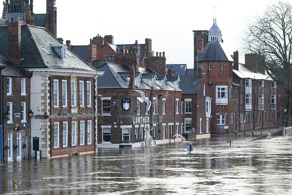
Meteorologists were still shocked by the event in the Northeast last week. The flooding was predicted, but seeing flood waters engulf New York City wasn't something anybody thought would happen.
The Surprising Event
Alex Lamers, meteorologist at the Weather Prediction Center said: "As you see it unfold, you're just gripped with this growing pit in your stomach when you look at this data on your screen and it keeps adding up to something very bad happening."
As everyone watched what took place in the Northeast because of Ida's remnants, a lot of jaws dropped as the surprising pictures began to emerge.
The reason for this wasn't because the prediction was a bust. In fact, the prediction was accurate. The forecast center was observing the possibility for major flooding three days before the event.
Last Wednesday was labeled as a day with "high risk" for torrential rainfall. That only occurs around 4% of the time, so in the weather community these times are taken very seriously.
Torrential Rainfall
Lamers was present at the forecast center that day, observing as it went down in actual time. So, Jennifer Gray chose to give him a call in order to know his thoughts on what took place that day.
Lamers said: "Over the course of the day there was just a growing concern. As things started coming together and seeing how the storm would likely track and the possibility that this would move right up the interstate into (New York City), and that's what happened."
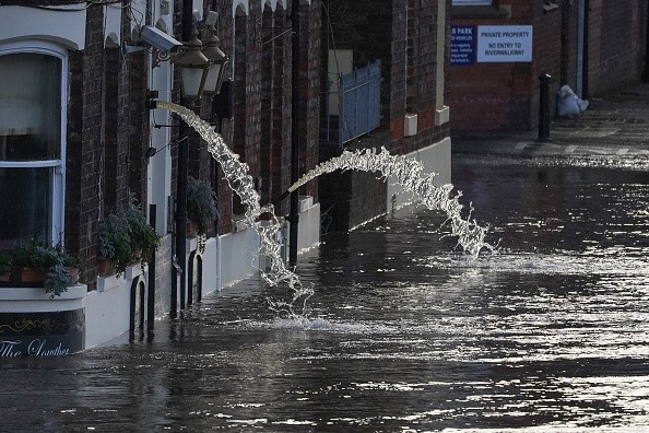
The totals of the rainfalls were deeply shocking, but what was even more surprising was the fastness of the rain as it came down.
Lamers said "the fact you have those extreme rain rates" that were lined up over that densely populated region is the reason it happened the way it did.
What Could have Caused the Catastrophe?
What basically caused the catastrophe was a lot of rain within a short amount of time. It's one thing to witness an inch of rainfall through the day; having that inch fall in 10 minutes is another.
Predicting specifically the region where the most intense bands of rain will take place is not possible until a few hours prior, and seeing them positioned over New York City which is a very populated city is shocking.
Making references to two major airports Lamers said: "I think the thing that stands out to me are the heaviest rain rates were lined up perfectly with one of the most densely populated cities in the country. Twenty to 30 miles can make a huge difference. JFK had less than 3 inches, while Newark had over 9."
Over 10 inches of rain was reported close to Elizabeth, New Jersey. In just one hour, Central Park witnessed over three 3 of rain .
Related Article : Unpredictable Weather May Lead to Flash Flooding and Rain Hazards
For more news, updates about floods and similar topics don't forget to follow Nature World News!
© 2026 NatureWorldNews.com All rights reserved. Do not reproduce without permission.


