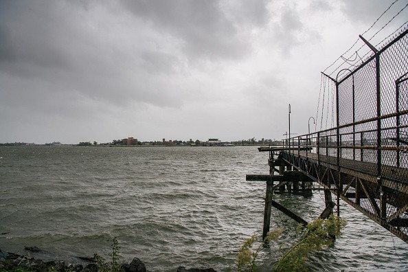
Storm surge from Hurricane Ida prompted the Mississippi River to rise by almost seven feet. Both the storm surge and the 150 mph winds are capable of stoping the flow of the river and literally make it move in the opposite direction.
Hurricane Ida
A supervising hydrologist with the USGS Lower Mississippi Gulf Water Science Center in Baton Rouge, Louisiana, named Scott Perrien told CNN: "During that time, the flow of the river slowed from about 2 feet per second down to about half a foot per second in the other direction."
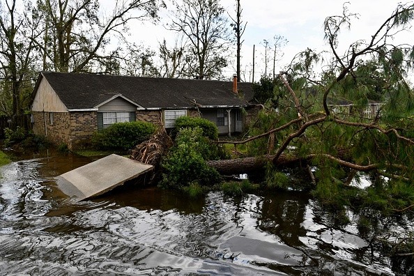
Perrien revealed that Ida is bringing about flooding up and down the river and also gave a warning that it will only get worse as the storm propels inland.
Perrien said over a large area, the effects of the storm are touching the river, till the region of Baton Rouge, in the past 12 hours the river has increased to 1.5 feet as the surge moves up the river. And there is a possibility the water level will rise more in hours to come in Baton Rouge.
Storm Surge
The storm surge was so intense to the extent that two ferries separated from their moorings and were floating in a way that can't be controlled down the river.
Perrien said for the river to reverse directions is "extremely uncommon" but noted that it took place amid Hurricane Katrina.
Perrien said: "I remember, offhand, that there was some flow reversal of the Mississippi River during Hurricane Katrina, but it is extremely uncommon."
The National Hurricane Center (NHC) said early Sunday afternoon, Ida made landfall close to Port Fourchon, Louisiana, as a very dangerous Category 4 hurricane accompanied with winds of 150 mph. The hurricane reached the area on the 16th anniversary of the historically disastrous Hurricane Katrina.
Perrien specified that the gauge does not take a measurement of the entire river's flow, so there is a possibility that the deeper part of the river did not reverse flow directions.
Category 4 Storm
Early Sunday morning, Ida turned into a Category 4 storm and has tied as the most powerful storm in Louisiana ever with last year's Laura and 1856 Last Island Hurricane - all having 150 mph top winds.
During Hurricane Laura, powerful winds touched the top portion of the Mississippi River upriver distant from the Gulf and reduced the main current in the river.
The National Hurricane Center (NHC) said Hurricane Ida is predicted to bring a lower storm surge of about 12-16 feet to some regions of southeast Louisiana. And in a region close to New Orleans it's anticipated to be even lower - about 8-12 feet outside New Orleans and along Lake Pontchartrain it should be 5-8 feet.
For more news, updates about Hurricane Ida and similar topics don't forget to follow Nature World News!
© 2026 NatureWorldNews.com All rights reserved. Do not reproduce without permission.


