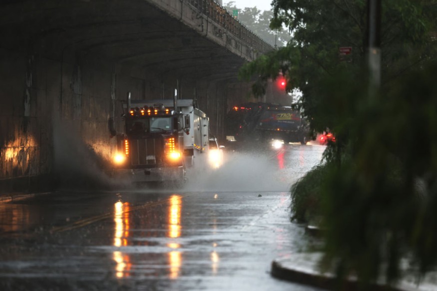
After heavy storms swept across the Midwest on Tuesday, hundreds of thousands remained without power on Wednesday. In addition, meteorologists warn that severe storms might hit some of the same regions again on Wednesday night.
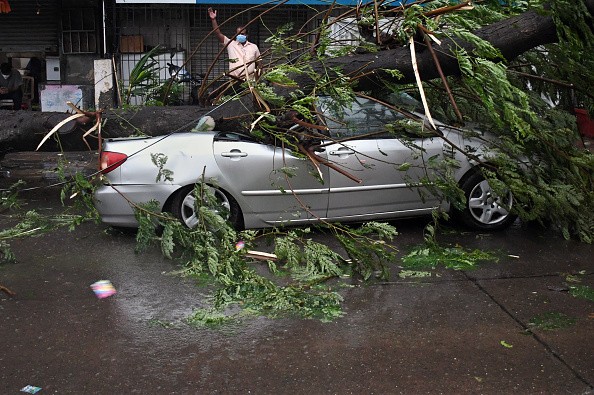
In addition, as the severe storms moved across Illinois, there were reports of downed trees. On Monday, the SPC's website showed almost two dozen tornado reports, most of which were from northeastern Illinois.
"Thunderstorms will spread from Missouri to Michigan through Wednesday night, bringing all types of severe weather," senior meteorologist Alex Sosnowski said.
"Impacts will range from severe wind gusts and flash flooding to hail and isolated tornadoes," according to the National Weather Service.
According to Sosnowski, the severity of some of the storms can equal that of previous days. During Wednesday evening, some of the fiercest storms, and therefore the greatest danger of isolated tornadoes, are expected to occur in eastern Wisconsin and the western and northern areas of Michigan's Lower Peninsula, he added.
Forecasters predict wind gusts could reach 80 mph in certain areas. According to the SPC, there is a higher probability of severe thunderstorms through Wednesday night across parts of Michigan, northern Illinois, and Wisconsin.
As a result, the SPC's third-highest danger level represents an elevated risk of severe weather.
The population of the increased risk area is roughly 17 million people. Chicago, Milwaukee, Madison, Wisconsin, and Grand Rapids, Michigan are all under threat.
According to the SPC, a larger population region is in danger of severe weather, the second-highest risk category. Detroit, Cleveland, Columbus, Ohio, and Pittsburgh are all at risk on Wednesday. Nearly 24 million people live in a low-risk areas.
The Midwest has been under a constant threat of severe weather for over a week, but circumstances in the central United States are anticipated to improve in the coming days.
According to analysts, a cold front is expected to sweep over the country later this week, bringing colder and more pleasant weather from the Midwest to the Northeast.
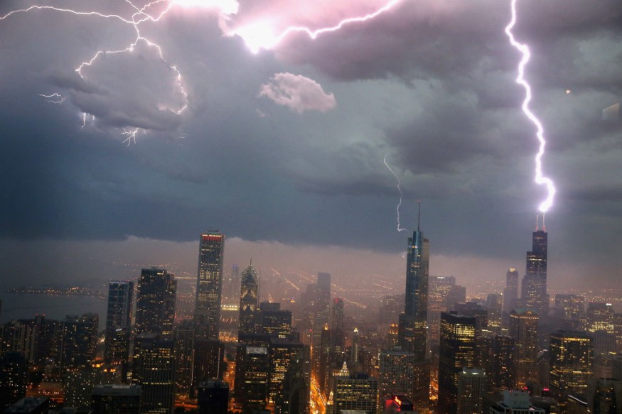
CHICAGO, IL - JUNE 12: Lightning strikes the Willis Tower (formerly Sears Tower) in downtown on June 12, 2013 in Chicago, Illinois. A massive storm system with heavy rain, high winds, hail and possible tornadoes is expected to move into Illinois and much of the central part of the Midwest today.Photo by Scott Olson/Getty Images
Any harmful meteorological phenomena that can cause damage, significant societal disturbance, or loss of human life are considered severe weather. The severity of extreme weather varies by latitude, height, elevation, and atmospheric conditions.
Severe weather includes thunderstorms, downbursts, tornadoes, waterspouts, tropical cyclones, extratropical cyclones, high winds, hail, heavy precipitation, and wildfires. In addition, blizzards (snowstorms), ice storms, and dust storms are all regional and seasonal extreme weather events.