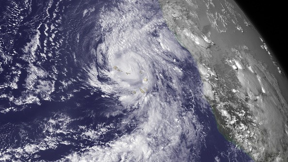
On Wednesday morning, hurricane forecasters were tracking a disturbance that's anticipated to propel over the Atlantic off the east coasts of Florida and Georgia. They said there are possibilities of gradual development.
Tropical Depression
As of 7 a.m., National Hurricane Center forecasters revealed they were observing a large trough of low pressure that's anticipated to propel off the coast by the ending of this week.
They said it is expected that the environmental conditions will be marginally favorable for some slow development over the weekend and into the beginning of next week.
It is anticipated that the system will meander off the coasts of South Carolina, Georgia and northeast Florida. There is a 20% chance of it developing into at least a tropical depression in five days.
When you take a look at the graphics the shaded part is where there is a possibility of storm development and is not a track. The National Hurricane Center publicizes a track when a formation of tropical depression happens or is about to.
Also Read: 'Space Hurricane' Detected Flying Above North Pole for the First Time in History
Tropical Cyclones
In order of increasing strength, the categories include tropical depression, tropical storm, and hurricane - categories 1 through 5. Generally, systems are given their names when they progress into tropical storm. Fred is the next name available.
A sum of five tropical cyclones all over the wold has been given the name Fred. In the North Atlantic, Hurricane Fred (2009) is one of the most powerful hurricanes that has been recorded in the southeast tropical Atlantic, only third known major hurricane east of 35°W.
The easternmost hurricane that has ever happened in the tropical Atlantic is Hurricane Fred (2015), it is also the first one to propel through the Cape Verde islands since 1892. Fred replaced Fabian after it was retired following the 2003 season.
In the Western Pacific, Typhoon Fred (1991) (T9111, 12W) is a Category 2 typhoon that hit Vietnam and Hainan Island.
Super Typhoon Fred (1994) (T9416, 19W, Susang) is a Category 4 super typhoon that hit China, leading to extreme storm surge coupled with heavy flooding, resulting in more than 1,000 fatalities and billions of damages.
Hurricane Fred
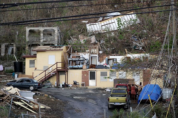
This hurricane was a dangerous hurricane that caused landfall in Corpus Christi, Texas. It developed late August 5th as a Tropical depression not very distant from Cuba then it obtained momentum as a Tropical storm.
This hurricane began to intensify in the Gulf of Mexico as a Category 1 progressed to Category 2 it was anticipated to affect Louisiana then it began to intensify so much that it became a Category 4 hurricane then progressed to Category 5 intensity, the day following that it made landfall at 4:37 AM in Corpus Christi Texas. It then began to rapidly diminish then it was a tropical storm and led to a lot of flooding before dissipating over Arkansas.
Related Article : Atlantic Hurricane Season 2021: Here Are the Most Vulnerable Areas
For more news, updates about hurricanes and similar topics don't forget to follow Nature World News!
© 2026 NatureWorldNews.com All rights reserved. Do not reproduce without permission.


