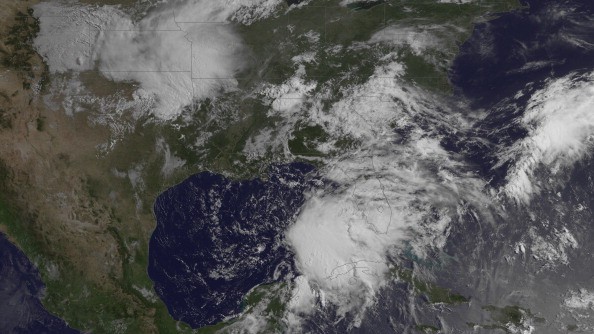
As AccuWeather meteorologists continue to closely monitor what the National Hurricane Center (NHC) has designated Potential Tropical Cyclone Three, a tropical storm warning was issued late Thursday afternoon for much of the United States Gulf Coast. The system was moving northward at 9 mph over the western Gulf of Mexico, with sustained winds of 30 mph, about nine mph shy of tropical storm force. According to the National Hurricane Center, the weather system was 455 miles south of Morgan City, Louisiana, as of Thursday evening.
From Intracoastal City, Louisiana, to the Alabama-Florida line, a tropical storm warning is in force. The alert also extends to the New Orleans metropolitan region. When tropical storm conditions are predicted somewhere in the area during the next 36 hours, a tropical storm warning is issued.
Potential Tropical Cyclone Three
On Thursday, Louisiana Governor John Bel Edwards declared a state of emergency ahead of potential tropical storm conditions. The declaration of a State of Emergency permits state resources to be used to assist in storm response.
The system may intensify into a tropical depression or subtropical storm later Thursday night or Friday early, according to forecasts. The further organization is expected through Friday night. The system can intensify enough to be designated Tropical Storm Claudette, the third named storm of the early 2021 Atlantic hurricane season - approximately two months ahead of usual in the basin.
Rain, Flooding, and Storm
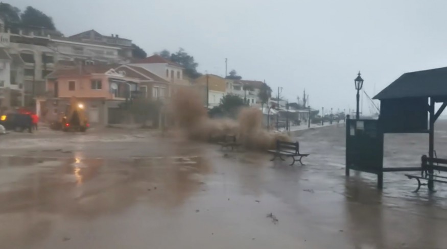
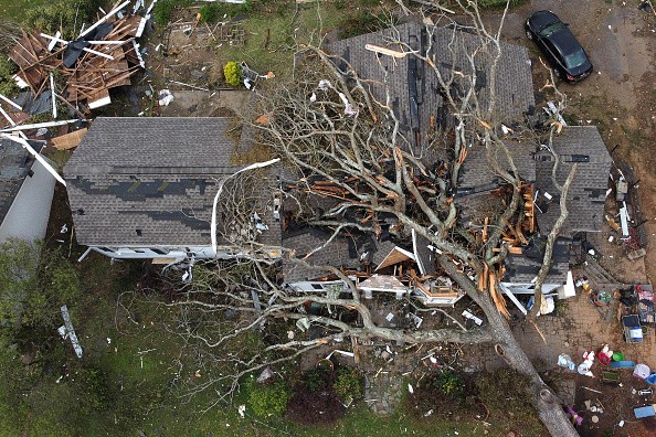
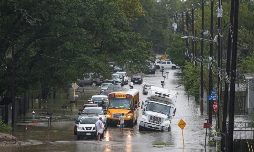
Due to the potential of flooding rains, the storm is projected to make landfall near the Gulf coast, most likely around the Louisiana shoreline Friday night to early Saturday as a 1 on the AccuWeather RealImpact ScaleTM for Hurricanes. Even while it isn't anticipated to intensify past tropical storm level - and maybe even subtropical storm status - before hitting the US, it will bring severe rain and floods, especially in Louisiana and Mississippi, where flooding has already occurred in recent weeks.
In terms of wind, rain, and other impacts to life and property from hurricanes and tropical storms, the scale for Hurricanes employs a 6-point system ranging from less than 1 to 5. In comparison, the Saffir-Simpson hurricane scale, which ranks hurricane severity on a 5-point scale from Category 1 to Category 5, solely considers the strength of the wind.
Due to expected rainy conditions, anyone having outdoor activities at home, camping, or at the beach this weekend in parts of the Southeast may want to reconsider their plans.
Gulf of Mexico
According to Senior Meteorologist Rob Miller, clusters of showers and thunderstorms across the central and western Gulf of Mexico and southeastern Mexico remained disorganized as of Thursday lunchtime.
At mid-levels of the sky, the same disruptive winds were forcing a substantial volume of dry air into a portion of the poorly structured storm.
As the system moves northward through Friday night, meteorologists anticipate enough organization will occur for a tropical or subtropical storm to emerge.
For more climate and weather updates, don't forget to follow Nature World News!
© 2026 NatureWorldNews.com All rights reserved. Do not reproduce without permission.


