A polar vortex is southbound, and it seems like it's not stopping any time soon. The weather pattern that's most at home over Earth's polar regions has started pushing south and is bringing plenty of frigid Arctic temperatures and snow along with it.
The polar vortex and its occasional southward migrations aren't a new thing, but some are wondering if the wintry impacts barreling down on the United States right now might become more frequent thanks to climate change.
Watching the winds around the edge of the polar vortex is one way to measure and monitor a meteorological event known as "sudden stratospheric warming" that can trigger extreme weather like what we're experiencing in North America now.
This has been difficult to research, partially since all the variables underlying the polar vortex's action are entirely understood. Because of this, physicists created a new instrument to study arch the phenomena. The European Space Agency's Aeolus wind monitoring satellite has been up and running for over a year.
"Changes in the wind structure in a sudden stratospheric warming event have never been observed directly at a global scale before," said Corwin Wright, Royal Society research fellow at the University of Bath in the UK. "So far, our understanding of these changes has been developed using point measurements, measurements along localized aircraft flight tracks, through the use of temperature observations, and, primarily, computer models."
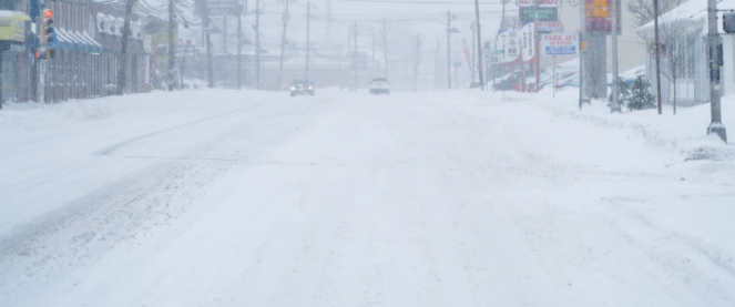
As of this writing Friday afternoon, storm and wind chill advisories affect at least part of over half the states in the US. Temperatures up to forty degrees below normal Fahrenheit can be expected, with the impacts centered on the Upper Midwest and Great Lakes regions. Bundle up, Minneapolis and Chicago.
"We are currently observing a polar vortex event where we see it split into two, with one spinning mass of air over the North Atlantic and one over the North Pacific," explained Anne Grete Straume, Aeolus mission scientist.
"The split leads to changes in the tropospheric circulation allowing cold air masses from the poles to more easily escape down to lower latitudes. At the moment, parts of North America seem to be experiencing colder weather than Europe. However, we have seen events of cold air reaching quite far south in Europe over the past few weeks causing, for example, heavy snowfall in Spain."
Related Article: Snowmageddon: Polar Vortex Split May Result to Weeks of Intense Winter
Polar Vortex
A polar vortex is a pattern of winds rising in the Arctic that resembles cyclones that spins around the northern hemisphere. It is formed during the polar winter, the moment that the stratospheric airs move in circular motions. The effect of a polar vortex may depend on the distance between the area and the Arctic regions.
There is a considerable chance that the cold air will remain bottled up over the Arctic region if the polar vortex remains strong and stable in one piece. However, snow cyclone may weaken and wobble. If that happens, it splits off and hurls southward.
"We are currently observing a polar vortex event where we see it split into two, with one spinning mass of air over the North Atlantic and one over the North Pacific," explained Anne Grete Straume, Aeolus mission scientist.
In addition to watching and analyzing the polar vortex in something closer to real time, the satellite will also help scientists understand if and what the relationship is between the phenomenon and our changing climate.
ALSO READ: Arctic's in Danger! 5 Infographics Showing the Alarming State of the Arctic
For more Arctic News, don't forget to follow Nature World News!
© 2026 NatureWorldNews.com All rights reserved. Do not reproduce without permission.


