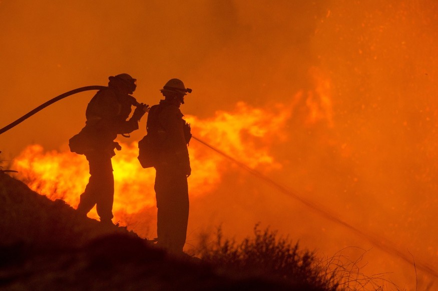
A mineral wildfire that started on Monday is still raging into the rugged terrains in Coalinga, California. The blaze has now covered more than 18,00 acres & only 25 percent is contained. Three structures were destroyed, and approximately 1200 firefighters are responding to contain the fire, according to a Twitter Post of Micheal IKahihifo (@Mike_Ikahihifo) of #FOX26AM.
The fire prompted evacuations in the city of Coalinga, Fresno County. Authorities closed State Highway 198 and the Monterey County line.
The evacuation order is still on in some areas, including the Bingham Springs Community. No injuries from the fire have been reported yet.
#MineralFire UPDATE: 18,000+ acres burned & 25% contained. 3 structures were destroyed. 1200+ first responders are working to contain this wildfire just west of Coalinga. We will be back live tomorrow morning for Day 5 of wildfire coverage on #FOX26AM #GREATDAY starting at 5am. pic.twitter.com/OuEENA3sUz - Michael Ikahihifo (@Mike_Ikahihifo) July 17, 2020
Meanwhile, authorities urge residents living north of Los Gatos Creek, east of Derrick Road, west of South San Joaquin Rocks Lookout Road and south of Spanish Lake along Juaquin Ridge and Wright Mountain to evacuate immediately as per the evacuation orders given on Thursday.
Residents near the mentioned areas are also asked to prepare for evacuation. Authorities also urged residents with pets and livestock should leave the soonest time.
The new evacuation order is an addition to the following areas which have been issued with evacuation orders as of Wednesday:
Los Gatos Creek Road from Indians Springs to Union Carbide Road
Highway 198 from Parsons Road west to the Monterey County line
The Monterey/ Fresno County line from Hwy 198 north to Coalinga/ Los Gatos Creek Road
Los Gatos Creek Road east to Parson/Mud Run Road and Mud Run/Parson Road south to Hwy 198
The firefighters are fighting an uphill battle as the fire is razing in steep and rugged topography that has not been on fire before.
Efforts to contain the fire are hampered by extreme fire behaviors, including rapid uphill and wind-driven runs.
"Overnight, firefighters continued to reinforce existing containment lines," the agency said in a statement.
AS of Thursday, authorities reported one damaged structure, but 60 structures remain threatened.
The cause of the fire is still under investigation, but California is on its dry season; thus, there is no rain in-store to douse the fire, senior meteorologist Jon Erdman said.
Some isolated thunderstorms are expected on Thursday afternoon, which could spark new wildlife or shift the wind direction that may cause existing wildfires to blaze in a new direction.
Meanwhile, the San Joaquin Valley Air Pollution Control District issued a health warning among Fresno County residents and urged those with asthma or respiratory issues to stay indoors. The counties of Merced, Madera, and Tulare are also affected by the smoke; thus, residents with respiratory problems are also advised to take precautions.
Firefighters, numbering to hundreds, are expected to battle the flame for days, depending on the weather situation.
To curb the spread of coronavirus, crews are required to practice new protocols such as wearing masks, social distancing, and avoid exposure at all cost.
An evacuation site was established at West Hills College in Coalinga by the Red Cross. Still, on Wednesday evening, Red Cross officials decided to close it as evacuees were able to make their own arrangements.
Red Cross, however, announced that they will still be available virtually should any arrangements are needed.
© 2026 NatureWorldNews.com All rights reserved. Do not reproduce without permission.


