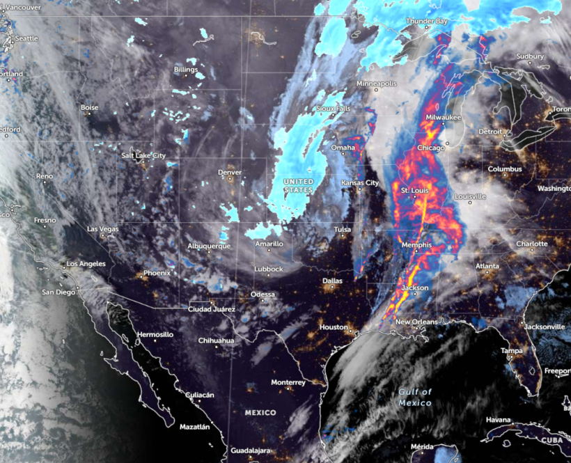
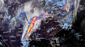
Pacific Northwest to Southwest can expect higher elevation snow and a mix of rain this week, according to a National Weather Service (NWS) forecast. A major winter storm is also likely in the Central Plains and Upper Mississippi Valley.
The NWS Weather Prediction Center warns of a possible stormy outlook in the Northern Plains. Motorists should stay alert for potential freezing rain and blizzard conditions this week. The widespread snow is expected in parts of western Nebraska, and central and northern Minnesota.
The windy conditions can reach over 50 mph, bringing possible blizzards. People can anticipate zero visibility, travel hazards, and power outages. Ice-covered roads and snow can significantly impact daily commutes in the region, causing slower commutes and travel disruptions.
Weather Outlook in Pacific Northwest to Southwest US

According to a forecast discussion by the National Weather Service (NWS), Pacific Northwest to Southwest US can expect higher elevation snow this week, as a potential winter storm impacts portions of Central Plains. Sleet and freezing rain are also likely.
In addition, the forecast shows that hazardous impacts are possible, bringing snow, ice, and strong winds. Residents should stay alert for power outages and tree damage. Homeowners should stay alert for local weather news, especially if they have any travel plans.
In the midweek, the snow and windy conditions can diminish in portions of the northwest and southwestern US. Blowing snow can likely persist on Wednesday in parts of Upper Great Lakes.
In Los Angeles, the forecast reveals that a wet weather outlook can unload this week. Potential mountain snow and rainy outlook are likely. In Salt Lake City, the forecast shows that lake-effect snow is possible on Tuesday morning. The forecast warns of potential snow-covered roads, impacting the daily commutes in the region.
On Tuesday, colder conditions are likely in the following areas:
- Winnipeg
- Bismarck
- Rapid City
- Sioux Falls
- Omaha
- Fargo
Possible snowfall can unload in Helena, Billings, Rapid City, Denver, Colorado Springs, and Sioux Falls. NWS also monitors a deep upper-level trough in the western parts of the US.
Weather in Other Portions of the US This Early Week
The weather report warns of a slight risk of excessive rainfall in the Middle and Lower Mississippi Valley, including in the Central Gulf Coast. The stormy conditions can also unload in the Southern Plains and Lower Great Lakes on Wednesday.
People should stay alert for showers and severe thunderstorms, with an Enhanced Risk of severe thunderstorms in the Lower Mississippi Valley. Frequent lightning is likely, with potential hail and isolated tornadoes.
In addition, heavy rain conditions can hit in Tennessee Valley and Lower Mississippi. Localized flooding and flooding can occur, particularly in low-lying areas.
Related Article: West Coast Weather Forecast: Mountain Snow, Stormy Conditions Likely This Wee
For more similar stories, don't forget to follow Nature World News
© 2024 NatureWorldNews.com All rights reserved. Do not reproduce without permission.

![Tsunami Hazard Zones: New US Map Shows Places at Risk of Flooding and Tsunamis Amid Rising Sea Levels [NOAA]](https://1471793142.rsc.cdn77.org/data/thumbs/full/70325/280/157/50/40/tsunami-hazard-zones-new-us-map-shows-places-at-risk-of-flooding-and-tsunamis-amid-rising-sea-levels-noaa.jpg)


