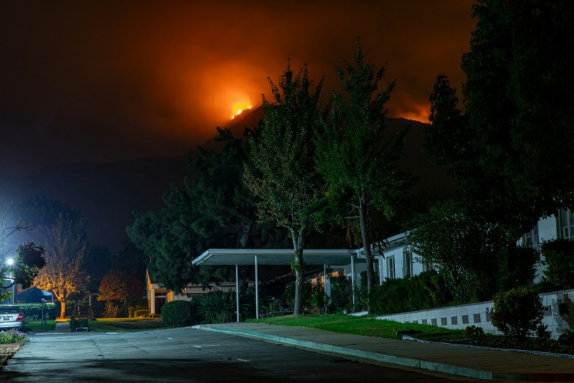
Wildfires have become a common occurrence in California in recent years, wherein forest fires or bushfires threaten multiple areas, especially wooded lands or towns surrounded by vegetation.
While some wildland fires are caused by human activities, climate change is being considered as the main cause behind the increasing frequency and intensity of the fires in some parts of the Golden State, where human fatalities have been reported in the past.
Now, the United States Government created a "wildfire map" to rank 11 California counties most at risk of the raging wildland fires, which thrive amid fire weather, drought, and dry conditions. Wildfire risk is not only prevalent in the state but also across the drought-stricken Southwest US region.
Globally, these natural disasters have been reported in other continents, including Europe and Asia, especially during their respective summer months.
California Wildfire Risks

(Photo : Photo by Nikolay Maslov on Unsplash)
California wildfires is an environmental and ecological problem affecting not only Californians but also native wildlife and vegetation. This year alone as of Friday, March 15, California's fire authorities reported the occurrence of 61 large wildfires that burnt 300 or more acres, with at least four wildfire-related fatalities, according to Cal Fire as cited by the website CalMatters. This wildfire data is expected to increase in the coming months.
Although California fires occur mostly between April and October, when the weather becomes drier, there is an indication that wildfires are already occurring outside the California fire season. While the atmospheric river-powered heavy rainfall events help to decrease the growth and spread of wildfires, the risks remain imminent due to the intensification of the climate crisis, as experts point out.
Also Read: US Weather Update: Wildfire Threats Southern Plains, North This Weekend
Wildfire Map
Based on data collected last March 2023 and risk assessments, the US Government's Federal Emergency Management Agency (FEMA) created a wildfire map across the US and this outline includes 11 counties in California below most at risk for wildfires:
- Riverside County
- San Diego County
- San Bernardino County
- Los Angeles County
- Ventura County
- Orange County
- Kern County
- Madera County
- Santa Barbara County
- Tuolumne County
- Calaveras County
These catastrophic disasters also occur in other states across the country. In its February 2024 Wildfires Report, the government's National Centers for Environmental Protection (NCEI) stated, in February, 3,809 fires burnt 1.4 million acres of land. From January to February, 4,803 fires also engulfed vast areas. Most of the wildfires reported last month were recorded, according to the NCEI. No data has been released yet for March 2024.
Intense global wildfires, fuelled by heatwaves, have been reported in multiple countries worldwide in recent years. In 2023, Canada experienced large wildfires in the provinces of Alberta, British Columbia, and Saskatchewan from early May until October, according to the Copernicus Atmosphere Monitoring Service. In Europe, Greece and Spain last year also witnessed some of the worst wildfires in decades.
Related Article: Wildfire Smoke in California Releases Dangerous Particulate Matter, Impacting Indigenous Communities [Study]
© 2024 NatureWorldNews.com All rights reserved. Do not reproduce without permission.


![Roundworms with Short Memories 'Stop Forgetting' When Frozen or Given Lithium [Study]](https://1471793142.rsc.cdn77.org/data/thumbs/full/70295/280/157/50/40/roundworms-with-short-memories-stop-forgetting-when-frozen-or-given-lithium-study.jpg)
