The United Kingdom is experiencing a cold snap that has brought snow and ice to many parts of the country. While some people are enjoying the scenic views and outdoor activities, others are facing travel disruptions and safety risks.
Here are some of the highlights and challenges of the winter weather in the UK.
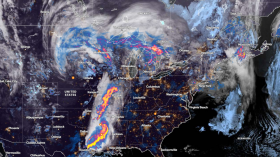
A Winter Wonderland or a Travel Nightmare? The UK Braces for More Snow(Photo : Christopher Furlong/Getty Images)
The Met Office has issued an update on when snow could fall once again in the UK. It comes after a blast of cold air saw wintry showers in parts of Scotland, Northern Ireland and England last week.
UK could see another dusting of snow pretty soon. It also mentions that both amber and yellow snow warnings had been issued last week, with snow falling on Thursday (February 8), causing some travel disruption on roads and with public transport.
The snowfall created picturesque scenes that many people captured on camera and shared on social media. Parks and gardens glistened under a blanket of snow; children reveled in play while adults admired the ephemeral beauty of nature.
However, the snow also brought challenges and dangers for travelers and commuters. Roads were not spared by the icy grip of winter; drivers had to deal with slippery conditions, reduced visibility and traffic delays. Public transport also faced difficulties, with some trains and buses cancelled or delayed due to the snow.
As temperatures continue to linger below freezing point, there's an air of anticipation mixed with caution. The Met Office's update isn't just a forecast but serves as a reminder for residents to brace themselves-for both the enchanting views set to unfold and potential travel chaos.
The weather forecast for the UK shows that the cold weather is not over yet, as more snow and ice are expected in the coming days and weeks.
According to the Met Office, there is a chance of snow showers across the UK on Monday, especially in the north and east. The temperatures will remain below average, with highs of 4°C and lows of -2°C.
The rest of the week will see a mix of sunny spells and showers, with some sleet and snow possible on higher ground. The temperatures will gradually rise, reaching highs of 8°C and lows of 2°C by Friday. However, the wind chill factor will make it feel colder than it actually is.
The weekend will bring more unsettled weather, with rain and strong winds affecting most parts of the country. There is also a risk of coastal flooding and gales in some areas. The temperatures will drop again, with highs of 6°C and lows of 0°C.
The long-range forecast for the end of February and the beginning of March suggests that the cold weather will persist, with further spells of snow and frost.
There is also a possibility of a sudden stratospheric warming event, which could disrupt the polar vortex and bring more cold air from the Arctic. This could result in a prolonged period of wintry weather, similar to the "Beast from the East" that hit the UK in 2018.


![Climate Change is Reducing Dust Levels Worldwide as Arctic Temperature Warms [Study]](https://1471793142.rsc.cdn77.org/data/thumbs/full/70320/280/157/50/40/climate-change-is-reducing-dust-levels-worldwide-as-arctic-temperature-warms-study.jpg)