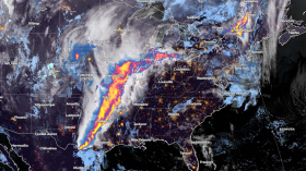
Weather experts warned that a dramatic return of La Niña is possible before this year's Atlantic Hurricane Season.
The National Weather Service has issued a La Niña watch, noting that it could replace the El Niño phenomenon before the end of the summer season.
Effects For Impending Hurricane Season
Authorities said that it could have implications for the impending Atlantic hurricane season and beyond.
They said that a transition from El Niño to El Niño Southern Oscillation (ENSO-neutral) is likely by April to June 2024, with 79% chance. Due to this, there is an increasing odds of the development of La Niña in June to August 2024, with 55% chance.
During January, above-average sea surface temperatures (SST) continued across most of the equatorial Pacific Ocean.
Meteorologists explained that SST anomalies weakened slightly in the eastern and east-central Pacific, as indicated by the weekly Niño index values. However, changes were more pronounced below the surface of the equatorial Pacific Ocean, with area-averaged subsurface temperature anomalies returning to near zero.
Weather forecasts noted that although above-average temperatures persisted in the upper 100 meters of the equatorial Pacific, below-average temperatures were widespread at greater depths.
Atmospheric anomalies across the tropical Pacific also weakened during January.
The low-level winds were seen to be near average over the equatorial Pacific, while upper-level wind anomalies were easterly over the east-central Pacific. On the other hand, convection remained slightly enhanced near the Date Line and was close to average around Indonesia.
Collectively, the coupled ocean-atmosphere system reflected a weakening El Niño phenomenon.
The most recent plume indicated a transition to ENSO-neutral during spring 2024, with La Niña potentially developing during summer 2024. Even though weather forecasts made through the spring season tend to be less reliable, there is a historical tendency for La Niña to follow strong El Niño events.
The forecast team is in agreement with the latest model guidance, with some uncertainty around the timing of transitions to ENSO-neutral and, following that, La Niña.
Officials noted that even as the current El Niño weakens, impacts on the United States could persist through April 2024.
They said that the timing of La Niña's arrival could coincide with the peak of the upcoming Atlantic hurricane season.
Further, a return to La Niña conditions quickly over the summer could result in an active tropical season. Meteorologists, however, explained that if it is slower to develop, the tropics may not be quite as active during the 2024 hurricane season.
If La Niña really does happen in that period, it may also have a heavy hand in the weather forecast for the United States next winter.
It will generally result in a dry and mild winter in the South, a colder winter in the Northeast and frequent storms in the Northwest.
Weather experts, however, said that it is still too early to make the call on what next winter will bring to US residents.
Stronger Trade Winds
The National Ocean Service said that La Niña means Little Girl in Spanish. La Niña is also sometimes called El Viejo, anti-El Niño, or simply "a cold event."
La Niña has the opposite effect of El Niño. During La Niña events, trade winds are even stronger than usual, pushing more warm water toward Asia.
Off the west coast of the Americas, upwelling increases, bringing cold, nutrient-rich water to the surface. These cold waters in the Pacific push the jet stream northward.
This condition tends to lead to drought in the southern US and heavy rains and flooding in the Pacific Northwest and Canada. During a La Niña year, winter temperatures are warmer than normal in the South and cooler than normal in the North.
Related Article: How Will the Damp La Niña Season Affect the Scorching American West?
© 2024 NatureWorldNews.com All rights reserved. Do not reproduce without permission.


![Tsunami Hazard Zones: New US Map Shows Places at Risk of Flooding and Tsunamis Amid Rising Sea Levels [NOAA]](https://1471793142.rsc.cdn77.org/data/thumbs/full/70325/280/157/50/40/tsunami-hazard-zones-new-us-map-shows-places-at-risk-of-flooding-and-tsunamis-amid-rising-sea-levels-noaa.jpg)


