Weather experts said that heaviest snowfall in two years is expected to hit the northeastern portion of the United States this weekend.
They also forecasted that the snow could spread over Appalachians to New England.
Meteorologists said that the accumulating snow is in store for approximately 60 million residents in the Northeast this weekend.
Road Travels Affected
They said that those who would be affected by the storm include hundreds of thousands of college students who are returning to campuses following the extended holiday break.
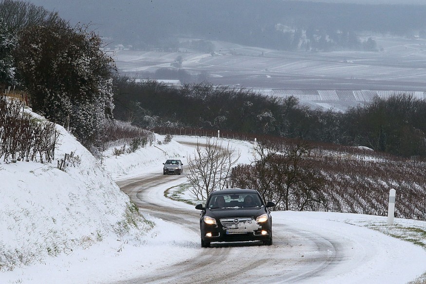
The snow will fall at the rate of an inch per hour or more around portions of New England, upstate New York and in parts of Pennsylvania. This snowfall is seen to affect the travels along roads.
This could cause some motorists who venture out during the height of the storm to be stranded in the highways from Saturday afternoon to early Sunday.
Meanwhile, snow will quickly spread over the central Appalachians and northern tier of the middle portion of the Atlantic on Saturday and then onward to much of New England during Saturday night.
Warm Atlantic Ocean waters, in the 40s F, is seen to play a huge role in the form of precipitation for the middle Atlantic coast and on Cape Cod, Massachusetts, by preventing snow or limiting the amount of snow.
Meteorologists from the National Weather Service said that an upper disturbance centered over the Great Lakes will support a winter storm across the eastern third of the country this weekend.
They warned that the public should expect heavy snow in interior portions of the northern Mid-Atlantic through New England this afternoon into Sunday.
There is also a high chance, from 50% to 90%, of exceeding 8 inches of snow from central Pennsylvania east through much of south-central New England.
Local snowfall over 12 inches of snow is possible within the heaviest bands.
The combination of heavy, wet snow and gusty winds from northeast Pennsylvania through much of the southern and central New England will result in difficult travel with some power outages and tree damage.
Gusty Winds
On the other hand, gusty onshore winds may lead to minor flooding along the Mid-Atlantic and southern New England coasts during the Sunday morning high tide cycle.
The probability for ice accumulations in excess of 0.25 inches along the Blue Ridge of North Carolina and Virginia are 30-50%.
This icing along with some areas of sleet, may produce hazardous travel conditions today.
Meteorologists said that Winter Storm Watches Warnings and Winter Weather Advisories are ineffect for portions of the Central Appalachians and interior Northeast.
Meanwhile, rain showers and scattered thunderstorms are likely across the southern Mid-Atlantic and Southeast within the warm sector of the winter storm today.
The next winter storm shifts down the West Coast today crossing the Desert Southwest Sunday before rapidly strengthening over the Southern Rockies/Plains on Sunday night to Monday.
Expect heavy snow in the higher elevations near the West Coast and Four Corners states this weekend before a swath of heavy snow develops over parts of the Southern/Central Plains on Monday.
Related Article : Snow Falls At Moderate To Heavy Pace Over Northern New Mexico, Expected To Spread In Texas
© 2025 NatureWorldNews.com All rights reserved. Do not reproduce without permission.


