The National Weather Service (NWS) reported that strong winds could hit portions of New Mexico and Arizona this week. In Wyoming and Colorado, snowy conditions and rain are possible.
November's first week brought significant travel concerns in the US, especially in the Midwest, Pacific Northwest, Great Lakes and Northeastern US.
A rain/snow mix pushes into the Northland Tuesday afternoon into Wednesday morning before precip changes over to mainly rain on Wednesday. Higher terrain of the North Shore could see snow amounts up to 3 to 5 inches. #mnwx #wiwx pic.twitter.com/BQ2Q0uo9Tt
— NWS Duluth (@NWSduluth) November 6, 2023
People with travel plans should watch out for potential travel dangers this week due to the mix of snow and rain. In addition, the strong winds can become favorable for wildfires due to low humidity and warmer outlook.
Strong Winds, Fire Hazards: Where Will It Impact?
The National Weather Service (NWS) monitors an upper-level trough in Eastern and Western Mexico. On Tuesday, a strong wind outlook could unfold in the region.
Residents can also anticipate above-average temperatures.
In Albuquerque, the advisory warned of a Red Flag Warning in the region this Tuesday. Wind gusts could reach up to 45 mph. Residents should stay alert for rapid developments of any fires in the area.
Residents should observe fire concerns this week and avoid outdoor burning as much as possible. In parts of Arizona, the forecast showed that low relative humidity and strong winds could unload in the region this midweek.
According to forecasts, the affected areas will be the following:
- Buffalo Pass
- Winslow
- Window Rock
- Chinle
- Dilkon
- Ganado
- Eagar-Springervill
- Saint Johns
- Holbrook
When a red flag warning is issued, critical fire weather conditions could emerge. Potential severe to extreme fires can happen in dry vegetation areas.
In the Little Colorado River Valley and Navajo Nation, southwestern winds could reach 20 to 30 mph. The strong winds could damage unsecured objects and cause power outages.
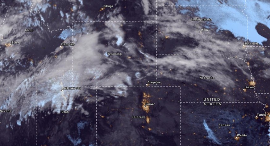
Weather in Colorado and Wyoming
In the latest advisory, Western and Central Wyoming can experience mountain snow in high-elevation areas or above 8000 feet. Over the western valleys, residents can anticipate light snow conditions.
From Tuesday to Sunday, the mix of rain and snow could continue in Western Wyoming. Regarding the temperatures, the cooler outlook could stay until this week.
In Duluth, the advisory showed that a rainy outlook with snow could unload on Tuesday in the region. In the higher terrain of North Shore, snow could reach from three to five inches.
In Northeast and North-Central Colorado, residents can anticipate dry and warm conditions. It can likely bring elevated fire concerns in the region, including on Palmer Drive.
Wind gusts could reach up to 50 mph in the Front Range mountains and high-elevation areas. On Tuesday, the temperatures could be above normal with chances of strong winds.
On the midweek, a storm system could emerge in the region. It will bring cooler temperatures.
Did you know? Weather Facts
In November 1977, the NWS Atlanta reported that Barnes Lake Dam collapsed. It unleashed a devasting 30-foot wall of water in areas of Toccoa Falls, causing widespread damage to life and property.
Related Article : "Witch Storm" November: How Does It Affect Weather in Midwest?
For more similar stories, don't forget to follow Nature World News.
© 2026 NatureWorldNews.com All rights reserved. Do not reproduce without permission.


