China is being threatened with torrential rains and big waves brought by Typhoon Koinu.
According to weather experts, Typhoon Koinu is tracking the direction towards the southern portion of China.
The Central Weather Administration in Taiwan said that Koinu was spotted at 071800Z at 21.3N 114.9E, having a movement of WNW 4km/hr.
It is packing minimum pressure 965 hpa and max sustained winds near center 35 meter per second and gusts of 45 meter per second. Meteorologists said that Koinu has an average radius of over 15m/s winds 150 km(170km NW quad. , 160km NE quad. , 140km SW quad. , 120km SE quad. ), and average radius of over 25m/s winds 70km(80km NW quad. , 80km NE quad. , 60km SW quad. , 60km SE quad. ).
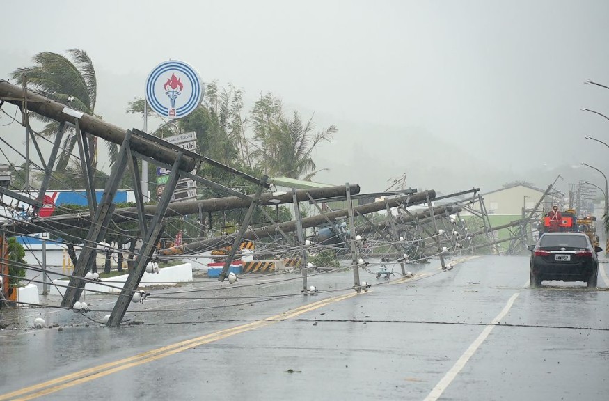
Koinu still has effects over Taiwan, with heavy rain advisory being raised over Hengchun Peninsula.
Rains, Waves Threaten China
In China, the operations of ferry services over Guangdong province have been stopped. Further, several flights and train services were also canceled to ensure the safety of travelers.
Weather experts noted that big waves up to nine meters were expected in the South China Sea over the weekend as part of the effects of the bad weather. This prompted authorities to raise an orange alert, which is considered as the second highest in the four-colored warning system.
The National Meteorological Center said that the China Meteorological Administration had activated level three emergency responses in order to provide refined services for addressing the impacts of Typhoon Koinu.
Under this emergency state, it is required for relevant meteorological departments and provincial meteorological services like Fujian and Guangdong to enter the emergency position immediately and put timely and precise forecast and refined services in place for the government, all the related sectors and for the general public.
Authorities said that Koinu is already heading west along China's southern coast at a speed of 5-10 kph, noting that the typhoon is expected to weaken into a strong tropical storm at the start of the week.
They said that under the influence of Koinu's rainbands and the monsoon, it will be cooler and be windy with squally showers over the coast of Guangdong.
Meanwhile, with Koinu departing and weakening, the weather will improve over the coast of Guangdong in the middle part of this week.
Meteorologists said that under the influence of a dry northeast monsoon, it will be mainly fine over southern China in the middle and latter parts of this week. On the other hand, an area of low pressure is expected to bring unsettled weather towards the central part of the South China Sea.
The NMC has called on residents and locals to remain vigilant and be on high alert for possible floods and prepare for typhoon emergency response measures.
Further, Shantou authorities in Guangdong province have placed restrictions to prevent movements along cross-bridges on Saturday for everyone's safety.
Hong Kong's Weather Forecast
Heavy rains are expected in Hong Kong as Koinu is also expected to hit the area.
Flood barriers and sandbags were already installed at vulnerable points around the city.
Gale winds are also expected to affect many parts of the island.
Related Video:
© 2026 NatureWorldNews.com All rights reserved. Do not reproduce without permission.


