Weather experts said that Koinu could threaten Taiwan and southeastern China as it gains strength while in the Philippine Sea.
They said that the center of Typhoon Koinu, which is currently known as Jenny in the Philippines, was moving near the southernmost coast of Taiwan late Wednesday.
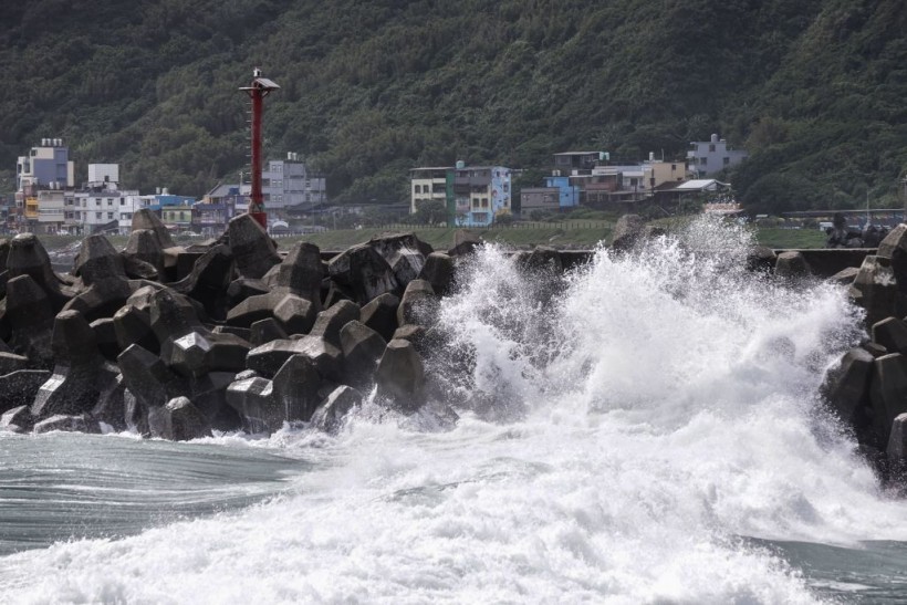
Meteorologists said that Koinu was packing maximum sustained winds of 103 mph, which is equivalent to that of a Category 2 hurricane on the Saffir-Simpson Hurricane Wind Scale.
Under this category, extensive damage to homes is expected as well as damage to power lines.
Furthermore, roads might be blocked due to shallow-rooted trees that might be uprooted.
Koinu's track
The Central Weather Administration in Taiwan said that Koinu's position 050000Z was at 21.9N 121.0E, having a movement of WNW 10km/hr.
It said that the minimum pressure was at 940 hpa and maximum sustained winds near center of 45 meter per second and gusts of 55 meter per second.
Officials from CWA said that Koinu has an average radius of over 15m/s winds 250km(260km NW quad. , 250km NE quad. , 250km SW quad. , 250km SE quad. ), and Aaerage radius of over 25m/s winds 90km (100km NW quad. , 90km NE quad. , 90km SW quad. , 90km SE quad.).
Due to Koinu, meteorologists issued extremely heavy rain or torrential rain advisory in Pingtung County Mountain Area, Hengchun Peninsula, Hualien County, and Taitung County.
Meanwhile, heavy rain or extremely heavy rain advisory was raised over Taipei City Mountain Area, New Taipei City Mountain Area, Kaohsiung City Mountain Area, Pingtung County, and Yilan County Mountain Area.
On the other hand, heavy rain advisory has been in effect over Keelung North Coast, Taoyuan City Mountain Area, Hsinchu County Mountain Area, Miaoli County Mountain Area, Taichung City Mountain Area, Nantou County Mountain Area, Kaohsiung City, Yilan County, Lanyu and Ludao Islands.
Beaches have been closed beginning Tuesday in Kenting National Park, which is situated in southern Taiwan, in preparation for the incoming storm conditions.
Meanwhile, numerous flights were cancelled across Taiwan as Koinu is expected to unleash impressive rain and wind field.
Furthermore, schools and businesses across the region were also shutdown on Wednesday as part of the preparation for the bad weather.
To recall, Koinu was formed on September 27 when a tropical zone of low pressure was created near Guam and the Northern Mariana Islands.
On Friday, it organized into a tropical depression over the central Philippine Sea.
Weather experts said Koinu also underwent rapid intensification.
Philippines
In the Philippines where Koinu was locally known as Jenny, the Philippine Atmospheric Geophysical and Astronomical Services Administration (PAGASA) said that Tropical Cyclone Wind Signal (TCWS) No. 3 remained hoisted over Itbayat, Batanes as the weather event made landfall in Pingtung County, Taiwan.
In its 11 a.m. weather bulletin, PAGASA added that TCWS No. 2 was raised over the rest of Batanes.
The following areas that are under TCWS No. 1 include Babuyan Islands; the northern portion of mainland Cagayan (Santa Ana, Gonzaga, Buguey, Santa Teresita, Lal-Lo, Camalaniugan, Pamplona, Claveria, Aparri, Ballesteros, Abulug, Allacapan, Sanchez-Mira, Santa Praxedes, Lasam, Gattaran); the northern portion of Apayao (Calanasan, Pudtol, Luna, Santa Marcela, Flora); and the northern portion of Ilocos Norte (Piddig, Bangui, Vintar, Burgos, Pagudpud, Bacarra, Adams, Pasuquin, Carasi, Dumalneg, Laoag City).
Related Article: Typhoon Doksuri to Bring Heavy Rain to Philippines Before Moving to Taiwan, China, Hongkong
© 2024 NatureWorldNews.com All rights reserved. Do not reproduce without permission.
![Tsunami Hazard Zones: New US Map Shows Places at Risk of Flooding and Tsunamis Amid Rising Sea Levels [NOAA]](https://1471793142.rsc.cdn77.org/data/thumbs/full/70325/280/157/50/40/tsunami-hazard-zones-new-us-map-shows-places-at-risk-of-flooding-and-tsunamis-amid-rising-sea-levels-noaa.jpg)
