The National Weather Service (NWS) reported that dry conditions and summer-like temperatures are likely in the Northern New England, Rockies, and Plains this week.
In the Northeast, residents can expect relief from the wet weather outlook and flood dangers.
The fall weather recently began. However, residents can anticipate unusual and above temperatures in parts of the Plains and New England.
Above-average temperatures in Northern New England and the Rockies

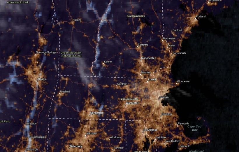
NESDIS via NOAA Satellite View as of September 27, 2023. Summer-like temperatures are expected this week in the Rockies, Plains and Northern New England. Meanwhile, relief from wet weather will be likely in the Northeast.
According to NWS' latest advisory, above-average warmth and summer-like temperatures are expected this week. There will be no relief from the dry conditions. Until September 29, the affected areas are:
- Southwest
- Rockies
- Plains
- Upper Great Lakes
- Mississippi Valley
- Northern New England
In the Mississippi River, experts were concerned about the low water level in the region due to prolonged dry conditions and lack of rainfall.
In the Northeast, residents can expect relief from flooding rain conditions in the region. The favorable weather can be ideal for outdoor activities in the region.
On the weekend, the weather will improve in the following areas:
- Portland
- Boston
- Virginia Beach
- New York
- Charleston
- Pittsburgh
- Washington
However, residents should still watch out for possible coastal flooding until Friday. Challenging surf conditions and coastal flooding are likely in Atlantic City, Charleston, Wilmington and Virginia Beach.
Meanwhile, the exceptional drought is forecast to continue in parts of the Southwest, Southern to Central Plains, and Upper and Lower Mississippi Valley.
Below-average temperatures and cooler weather
Cooler weather outlook can happen in Northwestern US to California.
As of September 26's advisory, the cold fronts in the Northwestern US and Northeast Pacific can help unleash the below-average temperatures in the region.
In addition, the rainy conditions can relieve the exceptional drought in the region. Mid-Atlantic, Northern Rockies and Southeast can expect cooler weather this midweek.
Also Read: US Weather Forecast: Isolated Tornadoes, Hail to Hit Midwest This Midweek
Weather in Wyoming and Colorado
The hazardous weather advisory warned of possible fire concerns in Colorado this week. The low humidity and gusty winds can favor the rapid intensification of fires.
On Wednesday, Colorado residents can expect possible rain and thunderstorms in Northeastern and North-Central portions.
Meanwhile, fire dangers are possible in Central and Southern Wyoming this week due to dry and warm conditions on Thursday. Elevated critical fire weather outlook is the concern due to above-normal temperatures and wind gusts reaching 25 to 35 mph.
On Sunday, there is a chance of slow levels and rainy conditions.
While the fall weather begins, homeowners should stay alert for possible damaging winds and isolated tornadoes. Hurricanes and tropical storms can still emerge in October, bringing potential flooding rainfall concerns.
As winter is near, homeowners should also check for potential home repairs after experiencing challenging hurricanes and severe thunderstorms.
Related Article: Stormy Conditions to Bring More Rain to Florida, Southern Georgia, Colorado
For more similar stories, don't forget to follow Nature World News.
© 2024 NatureWorldNews.com All rights reserved. Do not reproduce without permission.


![Roundworms with Short Memories 'Stop Forgetting' When Frozen or Given Lithium [Study]](https://1471793142.rsc.cdn77.org/data/thumbs/full/70295/280/157/50/40/roundworms-with-short-memories-stop-forgetting-when-frozen-or-given-lithium-study.jpg)

