The specific locations in the UK where snow is anticipated to fall within days as the Atlantic jet stream hammers Britain are shown below. Forecasters have revealed the precise day on which they anticipate areas of the UK will be pummeled by wind and rain as the powerful La Nina system takes grip.
The Met Office announced their countrywide projections for the first week of January through the end of the month on Wednesday, and snow may fall within days. The meteorological agency predicts that the west and northwest will be the worst hit by the turbulent weather, but that chilly temperatures will be felt throughout the country.
Exact area snow is expected to fall in days
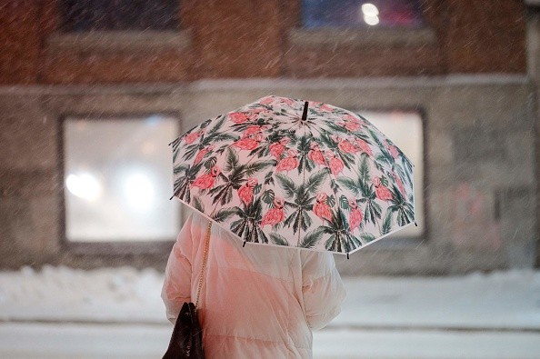
 (Photo : ANDREJ IVANOV/AFP via Getty Images)

From January 8 and on, wintry weather is expected to sweep throughout the country, bringing the risk of snow, as per Mirror. However, the white stuff will most likely be limited to high ground, most likely in the north of the United Kingdom and the Scottish Highlands.
"A westerly regime is most expected for the UK in the early half of January, which implies wet and windy conditions for many," said Meteorologist Rebekah Sherwin of The Met Office. Rain or showers will frequently be heaviest and most frequent in the west and northwest, although regions further south and east are not immune.
Temperatures will be near or above normal throughout, with any sleet or snow most likely limited to high land in the north. "Towards the middle of the month, there are some signs that the jet stream will decrease, which may be related to present and upcoming patterns of thunderstorm activity in the tropics," Rebekah noted.
And, like with the start of the year, next week is expected to deliver "uncertain circumstances," according to the prognosis from Thursday, January 19 to Thursday, February 2.
"Mid-January is anticipated to bring less unsettled weather, with more protracted drier interludes for most locations, increasing the frequency of overnight frost and morning fog, as well as perhaps lower daytime temperatures," the prediction concludes. Showers or longer bouts of rain are possible, however primarily restricted to the north and northwest.
Toward the season's conclusion, a return to generally milder and unsettled conditions is expected, with periods of wet and windy weather possible throughout all locations and only brief dry interludes.
2022 was the warmest year ever
According to the Met Office, last year was the warmest year on record in the United Kingdom, as per BBC. The average annual temperature in 2022 will be more than 10 degrees Celsius for the first time.
The 12-month average temperature was 10.03 degrees Celsius, surpassing the previous all-time high of 9.88 degrees Celsius in 2014. It implies that 15 of the top 20 hottest years on record in the UK have all occurred this century, with the full top 10 occurring within the last two decades.
"Although an arbitrary figure, the UK exceeding an annual average temperature of 10C is a significant milestone in our climatological history," said Dr Mark McCarthy, head of the Met Office National Climate Information Centre.
A heatwave in June 2022 caused the UK to have its fourth hottest summer on record, with temperatures breaking 40 degrees Celsius for the first time, prompting the Met Office to issue its first-ever red alert for excessive heat.
On July 19, a temperature of 40.3 degrees Celsius was recorded at Coningsby in Lincolnshire. The scorching summer and months of little rainfall also dried up rivers, destroyed crops, and fueled wildfires, with broad regions of England officially declared to be under drought.
According to the Met Office, a UK mean temperature of 10 degrees Celsius would have been predicted once every 500 years in a natural climate - before people began releasing the gases responsible for climate change via activities such as burning fossil fuels.
However, it stated that this was now expected to happen every three to four years. According to a recent analysis on UK climate extremes, recent years have witnessed both greater maximum temperatures and longer hotter spells.
This pattern is expected to persist. By 2100, the UK might see 40°C days every three to four years. The Met Office predicted that at this point, with medium levels of greenhouse gas emissions, the 10C average temperature may occur virtually every year.
Related article: Heatwave to Hit the UK in April and Climate Change is to Blame: Met Office Forecast
© 2024 NatureWorldNews.com All rights reserved. Do not reproduce without permission.
![Tsunami Hazard Zones: New US Map Shows Places at Risk of Flooding and Tsunamis Amid Rising Sea Levels [NOAA]](https://1471793142.rsc.cdn77.org/data/thumbs/full/70325/280/157/50/40/tsunami-hazard-zones-new-us-map-shows-places-at-risk-of-flooding-and-tsunamis-amid-rising-sea-levels-noaa.jpg)


