The Met Office predictsed sporadic showers in the south and north, which will spread to other areas on Friday.
Some of these heavy and thunderous showers will impact the western and southern regions the hardest.
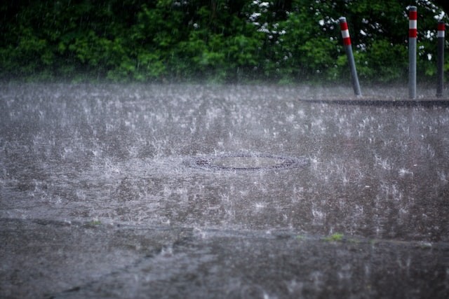
Torrential rain to hit Britain
 (Photo : Christian Lue/Unsplash)

Weather forecasters predicted that this will change over the weekend, with higher winds for Scotland on Saturday and severe winds for much of the UK on Sunday.
According to NetWeather.tv forecaster Jo Farrow, as an Atlantic low-pressure system passes across Ireland, there will be bands of rain from the west and southwest, but there will also be gaps and shelter.
Heavy and continuous rain is expected in Northern Ireland and South West Scotland, while the rain is most needed in eastern Scotland.
Rain is anticipated for Friday and the weekend, with the possibility of severe downpours, including torrential thundery downpours with floods.
At this point, it is unclear how the low pressure will move along the eastern Atlantic and how it will interact with continental Europe, as per Express.
Throughout the week, temperatures will range from the low to mid-twenties.
In advance of the Atlantic low pressure, warmer, more humid air will be pulled up over South East Britain.
This week has already witnessed heat and thunderstorms in Spain and France, and the sticky, unstable air is adding to our UK weekend weather mix.
Farrow noted that the major frontal boundary will not swing in from the southwest until Saturday.
These rain bands will be accompanied by cooler air.
The warmer, more humid air ahead of it and bands of heavy rain with bright or sunny intervals in between will allow temperatures to reach the mid to high twenties over England this weekend.
Many places will remain dry, with some cloud cover but feel extremely warm in any sunshine.
Overnight, the bands begin to provide considerable totals as the entire system pivots and swing the rain over Northern Ireland and western Britain, according to the meteorologist.
Meanwhile, the Met Office has announced the storm names for the storms that might produce amber or red weather warnings in 2022/23.
The new storms list, which was published in 2015, normally runs from early September to late August the following year, corresponding with the start of fall.
Also Read: Heatwave to Hit the UK in April and Climate Change is to Blame: Met Office Forecast
Traveling advice
Alex stated in the Met Office 10 Day Trend that Meteorological Autumn begins today, and there is good news for anybody searching for rain in the forecast.
High pressure, which we have been accustomed to this summer, will remain with us for a little longer, but by the weekend, things will change as low pressure takes the lead for several days, bringing damp and windy conditions.
During periods of inclement weather, such as rain, thunder, and gales, National Highways recommends that motorists check weather predictions before traveling and do vehicle checks, such as oil, tire, and coolant levels, to ensure that their vehicle is ready for the journey ahead.
According to National Highways, motorists should slow down when driving in severe rain or on wet roads and preserve a safe distance from the car in front.
They should also gradually take off the throttle if the steering becomes sluggish.
Rain makes it difficult for tires to grip the road and for vehicles to see ahead, considerably increasing the likelihood of a collision.
Related article: UK Weather: August Bank Holiday Will Be Expected With Heavy Rain While 26C Heatwave Returns Next Week
© 2024 NatureWorldNews.com All rights reserved. Do not reproduce without permission.
![Tsunami Hazard Zones: New US Map Shows Places at Risk of Flooding and Tsunamis Amid Rising Sea Levels [NOAA]](https://1471793142.rsc.cdn77.org/data/thumbs/full/70325/280/157/50/40/tsunami-hazard-zones-new-us-map-shows-places-at-risk-of-flooding-and-tsunamis-amid-rising-sea-levels-noaa.jpg)


