La Niña, as an atmospheric and ocean phenomenon, is a weather pattern known for causing the intermittent cooling of ocean surface temperatures, particularly in the central and east-central parts of the equatorial Pacific Ocean. Also referred to a cold event, the phenomenon is notoriously known for bringing exceptionally high amount of rainfall in a particular region at any time of the year.
The phenomenon indirectly wreaked havoc in Eastern Australia earlier this year. It caused widespread flooding due to La Niña-triggered heavy rain in Queensland, New South Wales, and other states. After being declared over in recent months, the La Niña season in Australia was thought to be temporarily gone for good. However, even various forecasts before said it could still recur in late 2022.
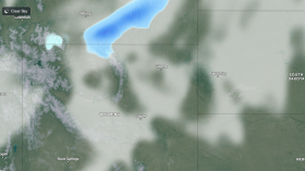
Now, a La Niña resurgence is possible in Australia during its upcoming spring season from September to November, causing the continuance of wet weather and the threat of renewed flooding. The wet outlook is in accordance to the latest weather forecast of Australian weather authorities earlier this week.
There is still no specific timetable for weather hazards related to the cold event. Yet, torrential rain is possible some parts of Queens land New South Wales in the coming weeks and months prior to the country's winter season in December. During this period, communities near rivers and other inland bodies of water are at risk of flooding.
La Niña Alert

The Bureau of Meteorology (BoM) on Tuesday, August 16, announced that it has elevated its 'La Niña WATCH' into a 'La Niña ALERT' which means there is a likelihood of La Niña returning in the spring, with an approximate three times greater than the normal risk.
The alert means there is increase in the chance of formation of the weather pattern. The BoM arrived at their conclusion based on climate models and indicators, indicating there is around 70% chance it could return later this year.
In Eastern Australia, the Bureau retains the elevated risk of flooding, as well as threats posed by wet soils, high rivers, and full dams. These entail that a substantial of rainfall could trigger and overflow and affect nearby areas.
Also Read: La Niña is Here: What Should We Expect
What is La Niña?
La Niña simply causes water to become cooler than normal, leading to abnormally cold ocean temperatures in the Equatorial Pacific. The opposite effect is manifested by another phenomenon called El Niño, which is also characterized by warm ocean temperatures in the same region of the Pacific Ocean, according to National Oceanic and Atmospheric Administration (NOAA)
In the United States, a La Niña year means winter temperatures are warmed than usual in the Southeast and cooler than normal in the Pacific Northwest.
In Australia, weather authorities have attributed La Niña to the three intense weather systems in its east coast from late February to early April this year. The systems caused massive flooding due to torrential rain, causing thousands of Australians in Sydney and other areas to evacuate, according to the Center for Disaster Philanthropy (CDP).
Related Article: Australia Will Experience More La Nina Weather This 2022
© 2024 NatureWorldNews.com All rights reserved. Do not reproduce without permission.