
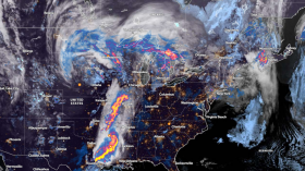
Kansas is in for another heatwave with high temperatures and humidity pushing for 110 degrees on the Heat Index Chart for the weekend. Experts are tracking a cold front for Monday.
SATURDAY:
Highs will range from 95 to 100°, and the heat index will be between 105 and 110°. The temperatures reported and predicted by 41KSHB Kansas City experts are five feet above the ground and under a shade. A 10-mph to 20-mph south breeze will temporarily reduce the high temperatures.
A cold front will be approaching Kansas. This afternoon's cold front is situated in central Nebraska and northern Iowa.
SUNDAY:
With heat index readings of 105°-110° and highs between 95° and 100°, it will be another extremely hot day. Once more, a south breeze of 10 to 20 mph will be beneficial.
Once more, a cold front will be moving toward Kansas. From central Iowa to southeast Nebraska, that cold front is situated. Due to the heavy clouds and rain, Nebraska's high temperatures will be within the 60s and 70s range. If not, temperatures behind the front will be within the 70s and 80s.
From the southern area of Kansas to southern Missouri, there will be a few showers and thunderstorms. Early on Sunday, a brief shower or thunderstorm could form. Overall, though, it will be another dry and extremely hot day.
MONDAY:
As it passes through Kansas, the front will wane. A dissipating front will be indicated by winds that are blowing in all directions. At least the front will arrive, bringing with it more clouds, showers, and thunderstorms.
The Upper 70s to middle 80s are expected for highs. There will still be a lot of humidity.
It appears that Monday's rainfall will resemble last Wednesday's.
Recalling Wednesday's Weather. Clouds and sporadic showers and thunderstorms were present throughout the day in Kansas.
As referenced from Wednesday's weather, many locations will likely see rain. The issue is that the majority of places will only see traces or up to a quarter of an inch. A quarter to an inch will fall on a select few fortunate farms and yards.
Recalling Wednesday's Weather. From Lawrence, Kansas to Clinton, Missouri, it rained 2" to 10" during the night.
With this next setup, there is less of a possibility for a zone of extremely heavy rain. The likelihood of rain is expected to increase over the next few days, according to experts.
Read also: Dangerously Hot Summer Conditions to Persist Across the United States: Weather Forecast
The Count Starts
Today, August 6, will be extremely hot with highs between 95° and 100°. Since Friday, when it reached 96 degrees, today has also reached 95 degrees or higher. The third consecutive day is likely to occur on Sunday, which will mark Kansas' second heat wave of 2022, 41KSHB Kansas City reports.
Kansas Air Quality
Although the weather is tough for Kansas, The Weather Channel data shows that air quality around Kansas is good and there are very low concentrations of allergens and pollutants that do not cause harm for the day.
Heat Advisory
On the other hand, a heat advisory is issued by the US National Weather Service, through AccuWeather, effective Friday, August 5 to Sunday, August 7 at 8 PM.
Related article: Flash Floods Possible for San Diego, Los Angeles as Thunderstorms Approach Following Two Months of Drought
© 2024 NatureWorldNews.com All rights reserved. Do not reproduce without permission.

![Climate Change is Reducing Dust Levels Worldwide as Arctic Temperature Warms [Study]](https://1471793142.rsc.cdn77.org/data/thumbs/full/70320/280/157/50/40/climate-change-is-reducing-dust-levels-worldwide-as-arctic-temperature-warms-study.jpg)
