A negative Indian Ocean Dipole has been forecasted to cause above-average rainfall in Eastern Australia during the ongoing winter season and the upcoming spring season.
The weather prediction is according to the Australian Government's Bureau of Meteorology (BoM), which warned another climate event will cause an extreme wet weather.
Other parts of Australia, including the state of Western Australia, could possibly be impacted by the negative dipole.
The said region previously received strong winds and torrential rain due to a series of cold fronts from the Indian Ocean, threatened by coastal erosion and flooding based on previous weather forecasts.
The weather event comes several months after the BoM declared the end of the La Niña weather pattern affecting Australia, as well as its announcement of the potential continuance of significant rainfall across the country for the remainder of the year.
During the first quarter of 2022, the weather pattern brought heavy downpour and flash floods in Eastern Australia, causing widespread disruption and evacuations.
Australia's winter season started in June and will last until August, while the spring season will commence from September to November.
In the coming weeks and months, the states of New South Wales and Queensland, as well as the Australian Capital Territory, could experience a recurrence of the adverse weather that transpired earlier this year.
A Wet Winter and Spring

The BoM's prediction of the negative Indian Ocean dipole was issued as millions of Australians are still recovering from multiple flooding incidents that occurred in previous months, according to The New Daily, Australia's news outlet.
This long-range weather outlook means there is reportedly a 50% chance of another La Niña occurrence for the remainder of 2022, according to the BoM Forecast, as cited by the media outlet.
This is the second consecutive year the weather agency confirmed the potential formation of the negative dipole.
If it does occur, it will also be the third year in a row of La Niña conditions, the New Daily added.
The Indian Ocean Dipole
The dipole and possible La Niña could also yield to a higher chance of further tropical cyclones and early monsoon, according to Australian Broadcasting Corporation.
The Australian media company said that the culprits behind such weather events are vast climate drivers found across the Pacific Ocean and Indian Ocean.
The BoM defines the Indian Ocean Dipole, shortly known as IOD, as the difference of sea surface temperature between to areas or poles, hence the term dipole.
In particular, the dipole pertains to the area in the western poles of the Arabian Sea (western Indian Ocean) and the eastern pole in the eastern Indian Ocean, mainly south of Indonesia.
Flood Watch and Heavy Rainfall
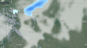
Amid the climatic phenomenon, the BoM on Thursday issued a flood watch for heavy rainfall caused by a complex low pressure system, affecting the catchments in the Mount Lofty Ranges and other parts of South Australia.
The inclement weather in the southern state will continue until Friday, August 5, wherein damaging winds, road closures, and riverine floodings are also possible.
Related Article: Australia Will Experience More La Nina Weather This 2022
© 2024 NatureWorldNews.com All rights reserved. Do not reproduce without permission.