Flash flooding is possible in North Island, New Zealand, in the coming hours and days.
This came after the New Zealand government's Meteorological Service (Met Service) issued severe weather and heavy rain warnings in the region on Wednesday, July 27.
Flood risk is likely in the next 24 hours along coastal areas, as well as low-lying lands near rivers and small inland bodies of water.
The weather warning was issued as heavy rain started to ease in the country's South Island but continue to affect North Island.
However, a new round of inclement weather due to prevailing winds is still expected to affect both islands.
Related rainfall is also possible in the central parts of the Oceania nation during the said period.
The weather authorities are also monitoring disruptive and life-threatening risks from the persistent downpours nationwide.
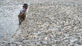
Local sources are already reporting that widespread disruption has occurred across the Canterbury region and record-breaking rainfall threatened the city of Christchurch with riverine flooding.
Severe thunderstorms have affected New Zealand since the onset of its winter season, which spans from June to August each year. In recent years, adverse weather in the form of torrential rain has led to widespread evacuation and declaration of disaster in the country.
Severe Weather Warning

The Met Service states the cause of the heavy downpour is due to prevailing winds such as the easterly flow and the northwesterly flow.
This has been the basis for the issuance of the severe weather warning, which include a heavy rain watch and a heavy rain warning.
The weather agency explains the moist easterly flow on South Island and the unsettled northwesterly flow on central-southern North Island will cause renewed torrential rain at least until Thursday, July 28.
With this, the Met Service advised the public monitor the latest weather forecasts since they can be created or changed with little or without warning anytime.
Also Read: Cyclone FIli: Storm Warnings for Heavy Rain and Severe Gales Issued for New Zealand
Heavy Rain Warning and Watch
The heavy rain alerts prompt the risk of making streams and rivers to increase their water levels rapidly.
Moreover, surface flooding and slips cannot be ruled out as driving conditions can be hazardous.
The following areas are at most risk from the looming wet weather:
- North Otago
- Dunedin
- Bay of Plenty
- Tongariro National Park
- Mount Taranaki
Canterbury Disruption
While the severe weather warnings are in place, the severe storm is already taking a toll in Canterbury.
Radio New Zealand (RNZ) reported that schools were closed, businesses were inundated, and dozens of roads closed across Canterbury, as heavy rain continues to affect the region.
In Christchurch, more than 55 millimeters of rainfall was reported in the garden city in the past 24 hours as of Wednesday, reaching an all-time high record of 212 millimeters for the month of July.
The previous record for July was 199 millimeters back in 1978, The New Zealand Herald reported.
The Met Service said that the city is "extremely wet" due to the overnight torrential rain, in addition to the waterlogged ground from last week's downpour of more than 100 millimeters.
Related Article: Severe Weather Warnings Issued for New Zealand Due to Heavy Rain and Snowfall
© 2024 NatureWorldNews.com All rights reserved. Do not reproduce without permission.