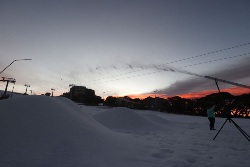
Cold weather continues to blanket a vast portion of eastern and southern Australia in this later part of the week, wherein New South Wales and other states witnessed continued cold front that brought snowfall and rain showers since the onset of the winter season on June 1.
Australia's Bureau of Meteorology (BoM) issued its latest forecast, saying that an intense cold southwesterly airstream will cause low-level snow, strong winds, and below-average temperatures in Tasmania this coming long weekend.
The forecast comes after record-breaking freezing temperatures were reported in the country, as experts deemed it as the coldest start of the Australian winter season in more than 100 years.
For more than 10 days, Tasmania, New South Wales, Victoria, and Australian Capital Territory have dealt with heavy snow, torrential rain, and damaging winds.
Australian meteorologists attributed a cold breeze from Antarctica to be the source of the ongoing cold front affecting southern and southeastern Australia.
This was also a partial case even prior to the country's winter season.
Tasmania Weather Forecast

According to the Australia weather forecast by BoM on Thursday, June 9, a "blast of cold air" will transpire in the late hours of Saturday, June 11, which will lower the snow level to approximately 200 meters for most of Tasmania.
The trend is reportedly expected to continue until the morning of Sunday, June 12, before the snow level starts to increase again by up to 800 meters on Sunday night.
In Hobart, the forecast suggested the possible accumulation of snow in the higher suburbs of the city.
In other parts of Tasmania, heavy snow accumulations are likely in the central, southern, and western areas, such as the ski slopes of the Ben Lomond mountain.
The BoM advised the public to monitor local weather developments, as well as to remain updated of the current advice and warnings.
Disruption to travel and businesses are possible in Tasmania and mainland Australia in the coming days.
Also Read: Australia Weather Update: BoM Forecasts Continuance of Cold Front Into the Weekend
Severe Weather Warning
The Australian weather agency also issued a Severe Weather Warning due to damaging wind gusts that can reach around 100 kilometers per hour in Tasmania.
The highest risk of this weather hazard affects the areas surrounding southeast Tasmania and areas near the Central Plateau.
The southern Tasmanian coast are also at risk during the weekend since the persistent strong southwesterly winds are producing "very large swells" and potentially "damaging surf," according to the BoM.
In addition, the severe weather may cause localized coastal erosion and coastal infrastructural damage.
Tasmania Cold Weather
The agency explained a large portion of a low pressure area and high pressure area are causing the cold weather, as the two pressure systems pulls cold air from Antarctica into Tasmania which is approximately 3,300 miles (5,300 kilometers) from the icy polar region.
Also called Antarctic blast, the Antarctic air previously brought cold weather, heavy rain, and snow to Southeast Australia in April, which was forecasted by BoM meteorologist Jonathan How, as cited by The Guardian.
Related Article: Record Breaking Freeze Hits Australia as Experts Recorded the Coldest Start of Winter for Over a Century
© 2024 NatureWorldNews.com All rights reserved. Do not reproduce without permission.


![Climate Change is Reducing Dust Levels Worldwide as Arctic Temperature Warms [Study]](https://1471793142.rsc.cdn77.org/data/thumbs/full/70320/280/157/50/40/climate-change-is-reducing-dust-levels-worldwide-as-arctic-temperature-warms-study.jpg)

![Tsunami Hazard Zones: New US Map Shows Places at Risk of Flooding and Tsunamis Amid Rising Sea Levels [NOAA]](https://1471793142.rsc.cdn77.org/data/thumbs/full/70325/280/157/50/40/tsunami-hazard-zones-new-us-map-shows-places-at-risk-of-flooding-and-tsunamis-amid-rising-sea-levels-noaa.jpg)
