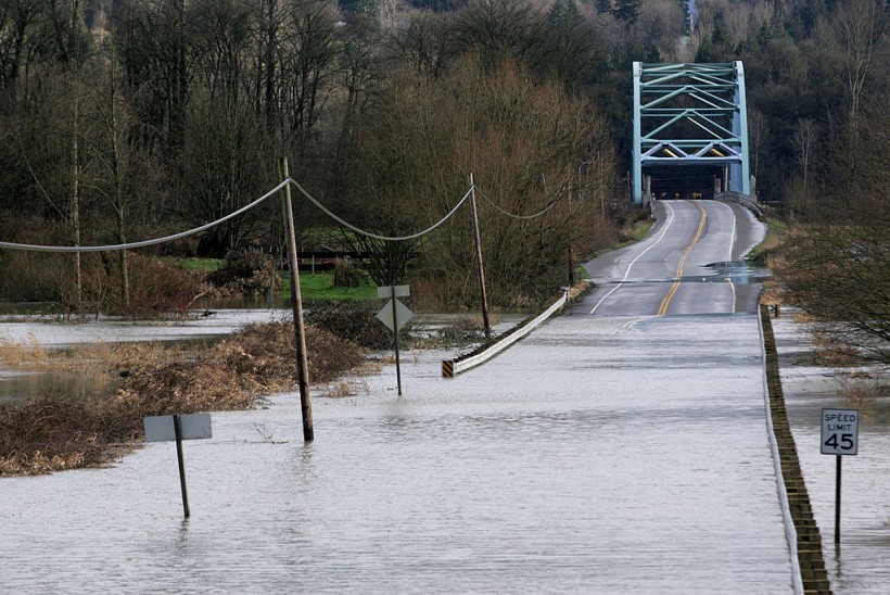
(Photo : Photo by Robert Sumner/Getty Images)
An 'atmospheric river' event is set to touch down in Western Washington tonight through Monday, dumping excessive rain across the region.
As of today, isolated scattered showers will be felt before the 'main weather event' later tonight around 8-9 PM which is expected to bring heavy and widespread rain surges, FOX13 reported. The 'spectacular' sunshine this morning associated with high temperatures will land in the low 50s, the news site added.
There has been a somewhat common perception that it rains all the time in Washington. In fact, Seattle ranks 44th among major U.S. cities, getting less rainfall annually than Boston, New York, Houston and Miami, according to Choose Washington State. It was believed that the climate and geography is "diverse and spectacular at almost every turn".
Wet and soggy complicated week of weather ahead
One of Washington's seven distinct physiographic regions is the Western Washington composed of Seattle, Tacoma, Olympia, Vancouver and Bellingham - all located on the west side of the state.
This week, rounds of drenching rain (may be gusty) is expected to linger through at least until Tuesday morning, but won't be bringing damaging winds in the region. FOX 13 Meteorologist Abby Acone tracks the weather event throughout the week and forecasted it to be 'wet, soggy, and complicated'.
The heavy rain poses risks for landslides in the next few days. Landslides are common in Washington, with many occurring annually as per the state's Department of Ecology.
There are also present threats of rising local river levels in response to the fire hose of moisture. Mason, Snohomish, King, Pierce and Lewis Counties could potentially experience river flooding today through Wednesday morning, but won't be a major flooding event by any stretch. The Skokomish River will likely flood, but overall, it seems like it will be a minor flooding event.
In addition, the forecast for mountain snow will be challenging because snow levels will ebb and flow the next few days due to switching between rain and snow. As of the moment, it seems most likely that Stevens and White Passes will get 12-18" of snow through Tuesday, getting more snow than the Snoqualmie Pass which is forecasted to have between 4-8" of snow. This is because temperatures will stay colder at those higher elevations.
Lastly, avalanche threat will also be elevated.
Also read: A Stormy Trend Is Expected To Bring Additional Rain and Mountain Snow to the Northwest
How the rain will be like going forward
Showers is expected to be fewer on Wednesday and isolated on Thursday and Friday. However, a heavier comeback of rain surge is expected next weekend.
As per the seven-day forecast, Sunday had spotty showers with forecast temp of 52, while in Monday and Tuesday, there will be heavy rains that could cause slides and river floods, with temperatures of 49 and 52, respectively. After the rainy days, Wednesday through Friday will have fewer and isolated showers, and a comeback of heavier rain on Saturday.
Going forward, there will be later sunsets due to the start of daylight-saving time. Tonight will have the first seven o'clock sunset of the season, while sunrise tomorrow is happening at 7:24.
Meteorologist Abby Acone of FOX13 News invites you to watch FOX 13 this week for weather updates.
Related article: Humid Heat Stress and Extremely Hot Weather Could Kill a Person Faster than We Thought
© 2024 NatureWorldNews.com All rights reserved. Do not reproduce without permission.


![Roundworms with Short Memories 'Stop Forgetting' When Frozen or Given Lithium [Study]](https://1471793142.rsc.cdn77.org/data/thumbs/full/70295/280/157/50/40/roundworms-with-short-memories-stop-forgetting-when-frozen-or-given-lithium-study.jpg)
