Weather experts said that a storm system is expected to spread rain over Ohio Valley and the interior Northeast.
They warned that a late-week storm would set up across the eastern portion of the United States and bring in rain as well as chances of snow.
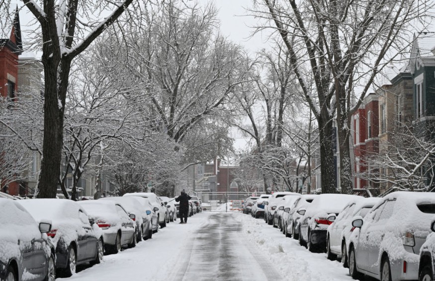
Leftover Snow
Based on the weather forecast, the leftover snow cover from the start of the weekend will melt quickly in the coming days.
Meanwhile, overnight lows will still dip below freezing across portions of the Great Lakes, Ohio Valley, the middle portion of the Atlantic and New England regions during the first half of this week.
Meteorologists said that this would mean any puddles or standing water from the snow melting could refreeze at night. This will later create slippery conditions in the next few days.
The National Weather Service said that much of the eastern two-thirds of the country would remain dry through the next couple of days under a slow-to-evolve weather pattern.
Further, a warming trend is expected to expand across the Great Plains through the middle of the week where an upper ridge is forecasted to build.
High temperatures will be between 15-25 degrees above average by Wednesday over much of the central portion of the US. The dry conditions will extend into portions of the Four Corners region as well.
Meanwhile, on the latter part of Wednesday, much of the energy associated with the upper-level trough moving through the western US will begin to move into the central Plains. During this period, a new low pressure system is forecasted to develop.
On the other hand, the West Coast will continue to be in the midst of an active weather pattern as the core of an energetic large-scale low pressure system pushes onshore.
Under this weather pattern, the entire California will remain under the impact of heavy precipitation.
The northern portion of California will be an area of concern as weather experts mentioned that additional heavy rainfall will lead to a slight risk of flash flooding into Tuesday.
Another area of concern will be along portions of coastal southern California where more focused heavy rainfall forced by local terrain will keep a moderate risk of flash flooding in place through the evening.
Cold Air
Meanwhile, portions of New York, Vermont, New Hampshire and Maine will experience the best chance of getting snow later in the week, especially across higher terrain. Cold air pressing southward out of Canada will linger across areas of the Catskills, Adirondacks, Green and White Mountain ranges.
Meteorologists said that into the Northeast, the storm will quickly track by on Friday. They warned that snow is possible, mainly in the terrain areas of the Northeast, with rain likely across the southern New England.
As overnight lows fall near or below freezing Friday night, there will be potential for snow or a mix of rain and snow farther south into southern New York, northern Pennsylvania and lower New England.
On the other hand, heavy snow can be expected over the higher elevations. On Tuesday, the low pressure system is forecasted to weaken.
This will allow the coverage and intensity of the rain or snow to progressively decrease with time.
Nevertheless, the additional residual energy arriving from the Pacific would result in more rounds of light to moderate elevation-dependent rain and snow into Wednesday.
Meanwhile, moisture from the weakening low pressure system will continue to push well into the Intermountain West.
This is seen to bring additional rounds of rain and snow across the Great Basin and into the northern Rockies over the next couple of days before reaching into the central Rockies and toward the Four Corners by Wednesday.
© 2026 NatureWorldNews.com All rights reserved. Do not reproduce without permission.


