Weather experts said that showers and thunderstorms are expected in areas in Central America.
They said that some of these areas were the ones hit by rains due to Tropical Storm Pilar.
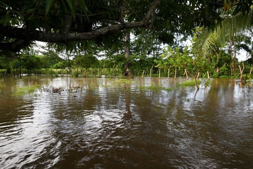
Meteorologists warned that the heavy rains would result in the potential for dangerous mudslides and flash floods.
The system began as a tropical wave that traveled westward from the coast of Africa a couple of weeks ago. Later on, it began to flare up as it entered the eastern Caribbean region.
Effects In Central America
Meteorologists noted that because the weather system is so close to land and will move onshore in Central America this weekend, the time has just about to run out for it to develop into a full-fledged tropical storm.
They said that regardless of the weather system's status, the tropical rainstorm will cause a significant uptick in drenching showers and locally gusty thunderstorms in areas, such as those located in southern Mexico to Costa Rica and Panama.
The bulk of the bad weather's effects are likely in Honduras, Nicaragua, Guatemala and El Salvador.
Furthermore, the expected torrential rains combined with the rugged terrain of the region can result in life-threatening mudslides and flash floods that put at risk the lives of residents.
Meanwhile, weather experts believed that the Atlantic would remain quiet after the tropical rainstorm affects Central America through next week.
Moreover, they said that a vast area of wind shear will be present over the Caribbean, Gulf of Mexico and southwestern Atlantic, which is considered as the primary development zone during November.
Soaked By Pilar
It was said that these areas were the locations that were also hit by Pilar.
The National Hurricane Center and Central Pacific Hurricane Center said that at 900 PM MDT (0300 UTC), the center of Tropical Storm Pilar was located near latitude 10.5 North, longitude 111.6 West.
Pilar is tracking the direction toward the west near 14 mph (22 km/h). A slower west-northwestward motion is expected to begin later tonight and continue through Sunday.
Meanwhile, a turn toward the northwest is expected Sunday night or Monday.
Pilar's maximum sustained winds have increased to near 50 mph (85 km/h) with higher gusts. Some slight additional strengthening is also possible in the evening.
Moreover, gradual weakening is expected to begin by late Sunday and continue through early next week.
Tropical-storm-force winds extend outward up to 70 miles (110 km) from the center while the estimated minimum central pressure is 1000 mb (29.53 inches).
Meteorologists said that a more significant increase in southwesterly shear is predicted Sunday night and Monday, and the steady weakening is anticipated during that time.
The small tropical cyclone is likely to succumb to these unfavorable conditions, and Pilar is forecasted to become a remnant low in 2-3 days, and dissipate shortly thereafter.
Pilar is still moving westward, but at a slightly slower forward speed of 12 kt.
A turn to the west-northwest and then northwest with a further reduction in forward speed is expected during the next 24-36 hours as a mid-level ridge to the north of Pilar weakens.
Related Article : Julia Slams Central America, Causing Flooding Rainfall and Strong Winds
© 2026 NatureWorldNews.com All rights reserved. Do not reproduce without permission.


