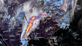
Experts have observed that the El Niño phenomenon would remain strong for the next six months, and one factor of this is the record-high ocean temperatures.
According to the National Oceanic and Atmospheric Administration (NOAA), El Niño is anticipated to continue through the Northern Hemisphere winter, with greater than 95 percent chance through December 2023 up to February 2024.
Experts underscored that the global climate models have predicted that the warmer-than-average Pacific ocean conditions are seen to not only last through the winter, but these will probably increase.
Read Also: El Nino Warning: Extreme Weather, Dry Conditions Expected in the Coming Months
Observations
Recent observations of scientists indicated that tropical atmospheric anomalies were also consistent with the El Niño phenomenon. They said that starting from mid-July, low-level winds were anomalously westerly over the western equatorial Pacific, while anomalous easterlies have prevailed over the eastern Pacific.
On the other hand, upper-level wind anomalies were westerly over the eastern Pacific. Experts said that convection continued to be enhanced around the International Date Line and was weakly suppressed within the vicinity of Indonesia.
According to the NOAA, the equatorial Southern Oscillation Index (SOI) and the traditional SOI were both negative. Collectively, the coupled ocean-atmosphere system reflected the El Niño phenomenon.
"The most recent IRI plume indicates El Niño will persist through the Northern Hemisphere winter 2023-24. Given recent developments, forecasters are more confident in a 'strong' El Niño event, with roughly two in three odds of an event reaching or exceeding 1.5 degree Celsius for the November-January seasonal average," NOAA's advisory stated.
Despite this, the experts pointed out that a strong El Niño phenomenon does not necessarily equate to a strong local El Niño effects due to the odds of related climate anomalies often lower than the chances of El Niño itself.
What is El Niño
Based on previous studies, El Niño is a naturally occurring phenomenon that causes transient and irregular warming of the Pacific Ocean. This often causes changes in worldwide weather patterns.
The onset of El Niño was announced in June.
The strongest climate impacts of this weather event are usually experienced during the Northern Hemisphere's winter and early spring, which often result in more rain and storms across the southern United States, southeastern South America, the Horn of Africa and eastern Asia.
Meanwhile, in other parts of the world, including the southeastern Africa and Indonesia, the El Niño phenomenon often leads to drier conditions, which may later increase the risk of drought.
Scientists are using the measurements of sea surface temperatures in the east-central tropical Pacific Ocean in order to track the progress of the El Niño phenomenon.
They noted that abnormally high temperatures seem to confirm early predictions that this year's phenomenon could be a big one. The NOAA said that atmospheric conditions are also consistent with a long-lasting El Niño.
Experts stressed how El Niño is a coupled phenomenon as they explained how the changes we see in the ocean surface temperatures must be matched by the changes observed in the atmospheric patterns above the tropical Pacific.
They said that more rain and clouds over the central Pacific could possibly mean that the system is engaged and that these conditions will last through the winter.
Related Article: El Nino Officially Developed: Warmer Weather Pattern Likely to Strengthen in 2024
Related Video:
© 2024 NatureWorldNews.com All rights reserved. Do not reproduce without permission.


![Tsunami Hazard Zones: New US Map Shows Places at Risk of Flooding and Tsunamis Amid Rising Sea Levels [NOAA]](https://1471793142.rsc.cdn77.org/data/thumbs/full/70325/280/157/50/40/tsunami-hazard-zones-new-us-map-shows-places-at-risk-of-flooding-and-tsunamis-amid-rising-sea-levels-noaa.jpg)


