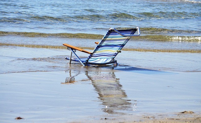
All of the beach chairs were swept into Florida's shorelines last week by a meteotsunami, an uncommon kind of tsunami that was not triggered by earthquakes.
Meteotsunami in Florida
As a result of a line of thunderstorms that produced a tsunami-like event that brought chairs crashing across the beach, Florida has officially experienced every form of weather imaginable. Just west of Tampa, Florida's Clearwater Beach was hit by a line of thunderstorms last week that also brought with it torrential rain, strong winds, and an unusual meteorological phenomenon that launched beach chairs flying.
The disruption that occurred at Clearwater Beach last Wednesday was caused by a particular sort of tsunami, according to the National Weather Service NWS forecasters. This sort of tsunami, known as a meteotsunami, was induced by gusty thunderstorms as opposed to the one brought on by earthquakes.
In contrast to tsunamis brought on by earthquakes, meteotsunamis are brought on by air pressure disturbances, which are frequently linked to powerful, swift storms. An inlet, bay, or weak continental shelf can magnify a storm-generated wave.
Meteotsunamis usually abate as soon as the leading edge of the storm, touches down on land. The whole process usually only takes an hour.
However, the wall of water might cause long-lasting harm to the coastline during that period.
Potent Thunderstorms Caused an Uncommon Tsunami
According to WTSP, on Wednesday at roughly 1:45 PM EDT, a line of strong thunderstorms moved inland across Clearwater Beach from the Gulf of Mexico. This weather phenomenon was caused by the shallow slope off the coast in conjunction with wind gusts of up to 40 mph.
Jesse Ferrell, a meteorologist and social media producer for AccuWeather, reported that the water levels at Clearwater Beach rose by 2.5 feet above normal.
After the wave had gone, beach chairs were seen being carried into the water in a picture posted on Twitter. No water rescues or injuries were reported.
....you can see the line showing how far up the beach the water advanced. pic.twitter.com/Lxh6XROHLR
— David Zierden (@FLClimateCenter) June 21, 2023
Though some people may not be familiar with the term, meteotsunamis do occur occasionally in various parts of the world.
The Great Lakes, the Gulf of Mexico, and the East Coast of the United States are where destructive meteotsunamis are most likely to occur in the country, where they may pose a bigger hazard than tsunamis caused by earthquakes.
The Mediterranean Sea, the Adriatic Sea, and off the Australian coast have all received reports of the phenomena.
Also Read: Atlantic Canada Weather: Atmospheric River To Bring Rainy Conditions, Flash Flooding Conditions
Historic Meteotsunamis
In Maine's Boothbay Harbor in 2008, one of the biggest meteotsunami incidents ever recorded in the United States took place. Over the space of 15 minutes, the port filled and then dried up three times, with waves as high as 12 feet. In the harbor, several vessels and other significant structures were damaged.
A meteotsunami struck the shore of New Jersey in 2013. According to the NWS, three persons were hurt when the 6-foot wave washed them off a pier and into the water. Due to the presence of a severe weather pattern nearby and the absence of an earthquake, the agency was able to certify it was a meteotsunami.
These unpredictable occurrences can range from small, hardly perceptible waves to larger ones that can flood coastal areas, making them difficult to forecast, AccuWeather reports.
Related Article : Ogallala World's Largest Aquifer Underneath Central US Starts to Dry Up, Farmers Worry
© 2026 NatureWorldNews.com All rights reserved. Do not reproduce without permission.


