A 5.9 magnitude earthquake struck northwest Iran, near the country's border with Turkey on Saturday, January 28.
Initial reports estimated the powerful tremor killed at least three people and injured more than 300 people, according to local sources.
Both Iranian and US seismic officials registered the quake with a 5.9 intensity, which is already relatively strong for the Middle Eastern nation.
Iran's Saturday earthquake is a result of yet another collision of tectonic plates underneath the country.
With a fragile infrastructure compared to other earthquake-proof nations, the impact of tremors in Iran can be devastating, based on previous reports.
While frequent, earthquakes in Iran can range from moderate to high intensity, which sometimes result in casualties and infrastructural damage.
Destructive Iran Earthquake
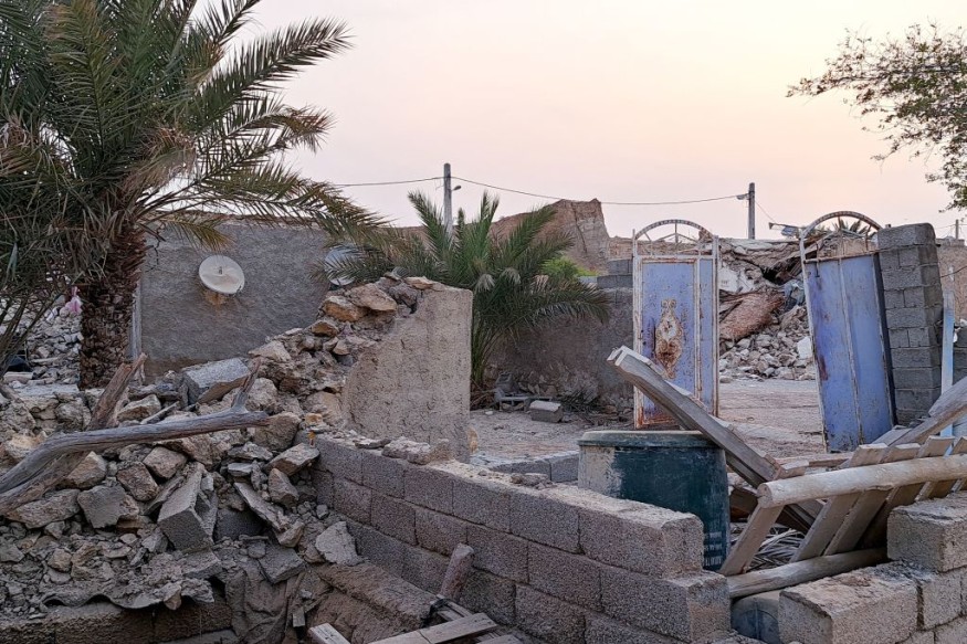
State media and official news agency IRNA reported the said death toll and cited the head of emergency services at a university in the city of Khoy, near the earthquake's epicenter.
An emergency official told the state TV the region was experiencing snow in some of its areas, with reported freezing temperatures and power cuts, as cited by Reuters.
The IRNA said the quake struck Khoy, which is situated in West Azerbaijan province, at around 9:444 p.m. local time, which cited the Iranian Seismological Center in the Iranian capital city of Tehran, according to CNN.
The United States Geological Survey (USGS) also recorded the earthquake as a 5.9 magnitude under the Richter scale, a parameter used to measure an earthquake's strength.
Iran's state media said the powerful tremor was felt in many regions across the province, raising concern among residents.
The quake's shockwave was also felt in several cities, including in the neighboring province of East Azerbaijan's Tabriz city.
Earthquake Impact
The USGS also said the magnitude 5.9 earthquake in Iran was also felt in Turkey and this case is plausible since the US seismic agency confirmed the epicenter is specifically located 14 kilometers south-southwest of Khoy.
Furthermore, the quake had a relatively low depth of 10 kilometers, meaning the epicenter can be more felt on the surface.
The USGS also reported two other earthquakes ranging 4.1 and 4.5 in intensity following the 5.9 quake.
This entails that aftershocks or other succeeding earthquake could strike the region in the coming hours or days.
Earthquakes in Iran
The American Iranian Council (AIC) stated Iran is an "extremely earthquake-prone country" and these natural disasters have caused loss of life and infrastructure damage worth billions of dollars.
With this, the Iranian government reportedly implemented some measures to mitigate the damage.
However, these mitigation efforts are not sufficient, the AIC said.
While disruptive and deadly earthquakes have occurred in the country in recent years, Iran's strongest earthquake in recorded history occurred in September 1978, wherein the Tabas region saw a 7.8 magnitude on the Richter scale, resulting in approximately 20,000 deaths, according to the website Worlddata.info.
© 2026 NatureWorldNews.com All rights reserved. Do not reproduce without permission.


