EOS Data Analytics and Greenpeace organized the webinar about practical applications of satellite imagery analytics for environmental monitoring, social initiatives, and sustainable agriculture.
EOS Data Analytics, a global provider of AI-powered satellite imagery analytics, jointly with Greenpeace Global Mapping Hub, held a webinar on leveraging satellite-based technology and advanced imagery analytics in agriculture, environmental monitoring, and social and environmental projects worldwide. The event took place on October 4, 2022.
As the use cases could be united around the ideas of improved resource management, resource availability to communities for meeting their needs, and ecological integrity, the speakers considered them in the sustainability context.

The presenters from EOSDA briefly discussed the company's operations, sustainability commitment, Academic Outreach Program, recent social projects, and product portfolio. The Greenpeace Global Mapping Hub specialist explained how their team uses EOSDA LandViewer to monitor forest land use changes in Argentina. The presentation ended with an overview of the EOS SAT agri-focused satellite constellation, whose first satellite will get into orbit in 2022.
(Webinar recording: Satellite tech use cases in environmental monitoring, social initiatives, and the agricultural sector. Video: EOS Data Analytics)
"The interest for precision farming among the industry players is driven by their intention to withstand competition amid increasing risks of crop failure caused by climate change-related weather extremes and ever-growing food demand. Since precision farming also focuses on improving resource use and minimizing the harmful impact of agriculture on the environment, we see how the industry is transforming via the adoption of related technologies," says Rim Elijah, VP of Sales at EOS Data Analytics.
EOSDA, the expert in satellite-based remote sensing and advanced data analysis, develops software and services to help customers automate and streamline operations and answer critical questions, which can eventually lead to an improved bottom line and reduced environmental footprint.

The company's activities (product development, provided services, and non-commercial projects) align with nine out of 17 Sustainable Development Goals introduced by the United Nations. For example, life on land, climate action, responsible production and consumption, sustainable cities and communities, or ending hunger.
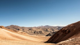
One of the first non-commercial initiatives was a participatory mapping project in Chad for indigenous communities who have been suffering the consequences of climate change - shrinking water and land - for decades.
"Regular people can't reverse major environmental changes but can negotiate and find a compromise co-sharing natural resources. That's the idea of the project to which we contributed. Our GIS specialists made a satellite-image-based map of areas with disputed resources, and the community members annotated it with natural and artificial objects crucial for everyday life. The map supplemented the agreement on who, when, and how can use land and water resources. Leaders of 116 communities from 23 villages joined the project," said Vera Petryk, Chief Marketing Officer at EOS Data Analytics.
Vera Petryk also told the attendees about the EOSDA Academic Outreach Program. It entails providing access to EOSDA LandViewer and EOSDA Crop Monitoring tools to students, scientists, and researchers working on environment-related issues.
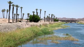
The Campaign Researcher for Greenpeace, Andino Sergio Domingo described how their team uses EOSDA LandViewer to monitor land use changes in Argentina's Chaco Forest, stretching along three provinces. EOSDA LandViewer is an online GIS assistant for searching and processing satellite images.
"A National Forest Law prohibits lumbering in these areas adopted at the end of 2007. Despite legal protection, these lands account for nearly 80% of total deforestation in the country. Our task is to monitor monthly changes in land use, go to places to expose violations, document them in reports and maps, and share the information to the public via press and social media. Thanks to EOSDA LandViewer, we can respond very rapidly to spotted violations," says Sergio Domingo.

EOSDA's Strategic Partnerships Lead Brijesh Thoppil introduced EOS SAT - the world's first agri-focused satellite constellation among companies utilizing remote sensing technologies. The seven-satellite swarm will fly in Low Earth orbit generating imagery of farmlands and forestlands for further processing and extracting valuable information about their state.
EOS SAT technology will help customers shift to sustainable agriculture practices without financial losses: optimize energy, water, and fuel use and introduce a variable application of inputs to maintain soil health while increasing yields.
© 2024 NatureWorldNews.com All rights reserved. Do not reproduce without permission.
* This is a contributed article and this content does not necessarily represent the views of natureworldnews.com