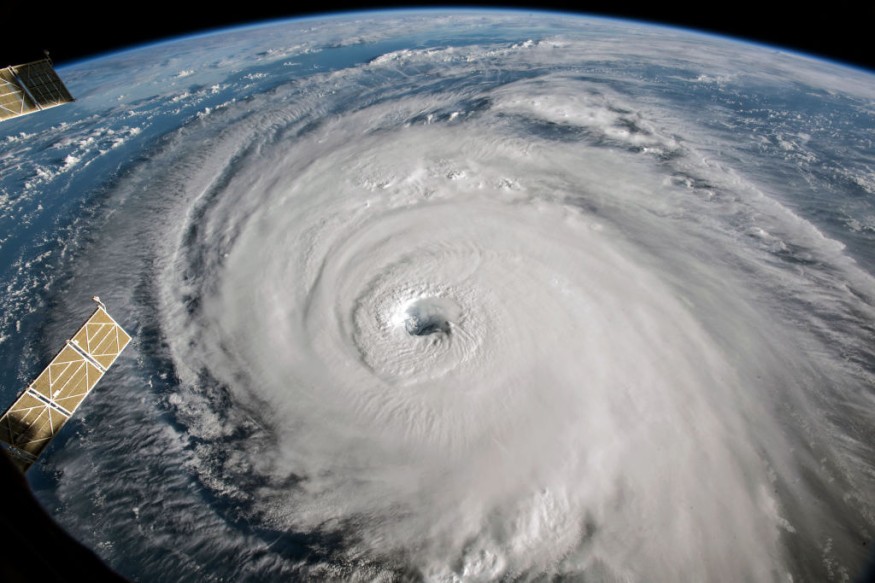
Is the tropical Atlantic about to get active? According to AccuWeather analysts, a prolonged drought in named tropical systems in the Atlantic Ocean may ease as August turns into September.
Colin Making Landfall
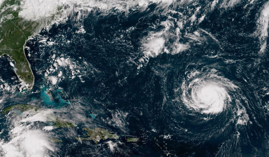
Since Tropical Storm Colin made landfall and then dissipated over the first weekend of July, it has been almost two months. Since then, the emergence of organized tropical threats has been hampered by the environmental circumstances this summer over a large portion of the basin. However, there are indications that tropical activity from the coast of Africa to the Caribbean may progressively grow as the peak of hurricane season draws near.
This week, the Atlantic Ocean and the Caribbean Sea saw a decrease in wind shear, according to AccuWeather Chief On-Air Meteorologist Bernie Rayno.
Also Read : Atlantic Hurricane Season to Peak this Month
Strong Winds
A belt of brisk winds that, when powerful, can obstruct or stop tropical development is known as wind shear. The principal development zone in the Atlantic basin has seen significant wind shear, dry air, and dust this summer. Further north over the Atlantic, a band of severe wind shear, dry air, and dust is still present, and it will probably continue to hinder development in the coming days.
There is moisture more to the south, along with less wind shear. There is potential for development as tropical disturbances, also known as tropical waves, continue to migrate westward in this moister zone with mild breezes.
It will be in a low shear and moistening environment when a tropical wave crosses the Caribbean this weekend and throughout the first part of next week. This could be sufficient to permit gradual growth, according to Rayno.
Weather Uncertainty
One or more tropical waves will move into another area of low wind shear and slightly moist conditions over the central Atlantic more than 1,000 miles to the east around the same time.
No certainty that any of these two regions will develop into a named tropical storm, not even with low wind shear and increased precipitation. Both systems haven't yet demonstrated any signs of growth, and they probably won't until this weekend at the earliest. AccuWeather meteorologists have given both a low chance of development due to the lengthy development time.
The disturbance, anticipated to move across the eastern and central Caribbean from this weekend until early next week, is currently being watched more closely because of its anticipated proximity to land and populated regions.
Weather Trajectory
It is more likely that this tropical wave will travel westward toward Central America next week if it cannot gather enough intensity while through the Caribbean. The system is more likely to turn northwest or northward into Cuba and maybe the United States if it develops into a depression, tropical storm, or hurricane.
From near the southeastern coast of the United States into the north-central region of the ocean, another area of the Atlantic has been calm since Colin formed in early July. It wouldn't be impossible for a non-tropical system to separate and eventually develop into a sub-tropical or tropical feature if a front was projected to stall or move slowly in this region next week.
Through September, when the hurricane season often peaks, more tropical waves will keep moving from Africa to the central Atlantic and Caribbean.
Related Article : Exposure to Major Disasters Can Cause Long-Term Mental Health Problems
For more climate and weather updates, don't forget to follow Nature World News
© 2026 NatureWorldNews.com All rights reserved. Do not reproduce without permission.


