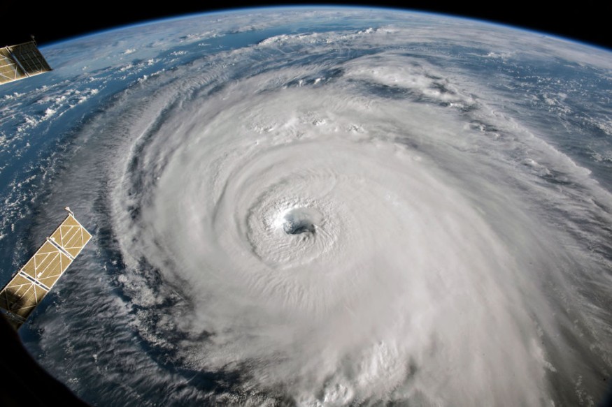
Hurricane Agatha is currently over the Eastern Pacific Ocean and is posing a primary threat to tourist beaches and fishing towns across the Pacific Coast of Mexico. Over the past 24 hours, Agatha has gained momentum and rapidly intensify from a tropical storm into a hurricane.
The U.S. National Hurricane Center (NHC) issued a reported statement that Agatha is expected to make landfall as a Category 3 hurricane in the Central American country on the afternoon or evening of Monday, May 30. The hurricane agency also warns Agatha could bring storm surges or large waves to coastal areas.
A recent weather forecast suggested Agatha could hit not only Mexico but also Florida and the Gulf Coast of the United States this week. While the NHC claimed it was too early to assume the storm's impact on the country, a warning was still issued to Americans to be prepared due to previous weather events involving hurricanes.
Over recent years, multiple hurricanes have wreaked havoc across the Atlantic and Gulf coasts of the US. Mexico and its nearby countries have also been caught in these storms' path of destruction.
In the coming months, succeeding hurricanes or unnamed storms after Agatha are likely to deliver powerful winds and heavy rain with flooding.
First Hurricane of 2022

The emergence of Hurricane Agatha marks previous predictions of meteorologists that the hurricane season will start earlier this year than previously thought. In the US, the hurricane season approximately spans from June 1 to November 30 annually.
With this, the NHC issued its first hurricane landfall weather advisory, as Agatha is expected to make landfall near Puerto Escondido and Puerto Angel in the southern Mexican state of Oaxaca, which consists of the tourist resorts of Huatulco, Mazunte, and Zipolite, as cited by the Associated Press.
The US media outlet also cited statements from Oaxaca's civil defense office that the "outer bands" of Agatha has already struck the coast.
Hurricane Warning and Measures
According to the NHC Weather Forecast, Hurricane Agatha will make its impact in southern Mexico until Friday, June 3, issuing a hurricane warning regarding the risk of coastal flooding and destructive waves in areas near Agatha's landfall site.
This coastal threat is possible due to Agatha's maximum sustained winds of 110 miles per hour (175 kilometers per hour) as of late Sunday, May 29. It was also during this period that the hurricane was spotted around 140 miles (225 kilometers) southwest of Puerto Angel and is moving in a northeastward direction.
A hurricane warning remains in effect between the port of Salina Cruz and the Lagunas de Chacahua.
Several local governments of Mexico have also been alerted of the approaching storm. In Huatulco, municipal authorities have ordered the "absolute closure" of all beach resorts and the famous "seven bays" which are only reachable by boat, according to the Associated Press.
Local schools in Huatulco have also been closed and the authorities erected emergency storm shelters.
In the coming days, the NHC predicted Agatha could dump between 10 and 16 inches of rain in Oaxaca and 5-10 inches in Chipias. The center also issued weather warnings for potential flash flooding and mudslides across the region, as cited by CBS News.
© 2026 NatureWorldNews.com All rights reserved. Do not reproduce without permission.


