Magma transfer beneath the seabed is identified as the reason in a distant place using a combination of geophysical approaches.
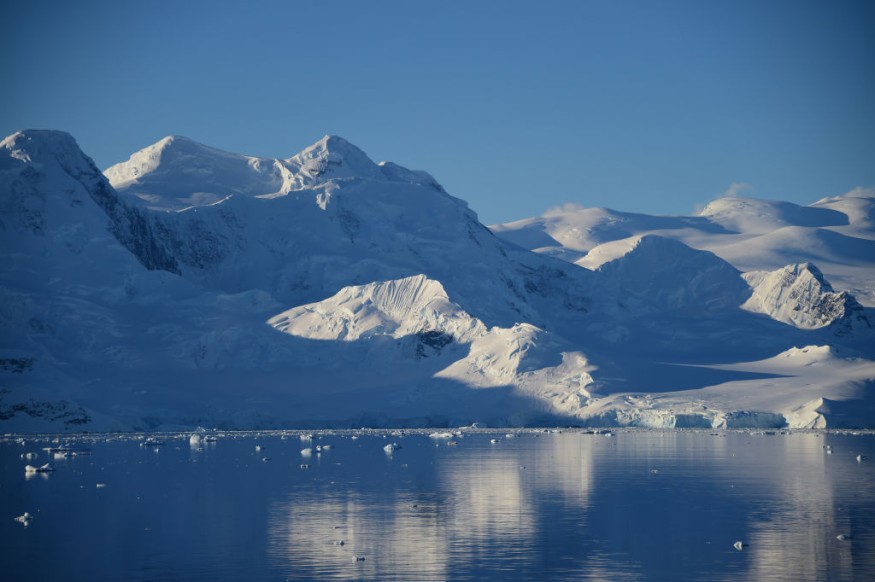
Volcanoes may be discovered even off the coast of Antarctica. In 2020, a swarm of more than 85,000 earthquakes was recorded at the deep-sea volcano Orca, inactive for a long time, a quake that had never been seen before in this location. An international team's work published in the journal Communications Earth and Environment shows that such phenomena may be observed and described in astonishing detail even in such distant and poorly instrumented places.
Collaboration
The study, coordinated by Simone Cesca of the German Research Centre for Geosciences (GFZ) Potsdam, included researchers from Germany, Italy, Poland, and the United States. They utilized seismological, geodetic, and remote sensing techniques to figure out how the swarm quake was triggered by the fast transport of magma from the Earth's mantle near the crust-mantle boundary, virtually the surface.
Earthquake Swarms
Swarm quakes are more common in volcanically active areas. As a result, fluid movement in the Earth's crust is the reason. Orca seamount is a massive undersea shield volcano with a base diameter of around 11 kilometers and roughly 900 meters above the seafloor. It is southwest of Argentina's southern point in the Bransfield Strait, an ocean waterway between the Antarctic Peninsula and the South Shetland Islands.
"Previously, seismicity in this area was mild. However, a strong seismic swarm began in August 2020, with over 85,000 earthquakes occurring less than a year. Simone Cesca, a scientist in GFZ's Section 2.1 Earthquake and Volcano Physics and primary author of the recently released paper, said, "It constitutes the biggest seismic unrest ever recorded there." On adjoining King George Island, a lateral ground displacement of more than ten centimeters and a modest uplift of roughly one centimeter coincided with the swarm.
Cesca collaborated on this research with colleagues from the National Institute of Oceanography and Applied Geophysics (OGS) and the University of Bologna (Italy), the Polish Academy of Sciences, Leibniz University Hannover, the German Aerospace Center (DLR), and the University of Potsdam. The difficulty was that the isolated location had few traditional seismological sensors, with only two seismic and two GNSS stations (ground stations of the Global Navigation Satellite System, which measure ground displacement).
Intensive Review
The researchers then reviewed data from more seismic stations and data from InSAR satellites, which employ radar interferometry to assess ground displacements to recreate the chronology and evolution of the unrest and discover its source. To appropriately understand the data, it was necessary to simulate the occurrences using a variety of geophysical approaches.
The researchers pushed back the start of the disturbance to August 10, 2020, and expanded the initial global seismic collection from 128 to over 85,000 incidents. Before fading, the swarm peaked with two major earthquakes on October 2 (Mw 5.9) and November 6 (Mw 6.0), 2020. Seismic activity has considerably diminished by February 2021.
Because seismic processes alone cannot explain the observed severe surface deformation on King George Island, the scientists identified a magma intrusion, or the migration of a greater volume of magma, as the primary source of the swarm quake. Geodetic data may be used to validate the presence of a volumetric magma intrusion independently.
From its beginning, seismicity migrated upward and then laterally: deeper, clustered earthquakes are thought to be the result of vertical magma propagation from a reservoir in the upper mantle or at the crust-mantle boundary, whereas shallower, crustal earthquakes extend NE-SW, triggered on top of the laterally growing magma dike, which reaches a length of about 20 kilometers.
Continous Activity
After nearly three months of steady activity, seismicity dropped sharply by mid-November, coinciding with the occurrence of the series' strongest earthquakes, measuring Mw 6.0. The termination of the swarm can be explained by the reduction of pressure in the magma dike that occurs when a big fault slips and might indicate the date of a seabed eruption that has yet to be confirmed by other evidence.
The scientists assessed the volume of the Bransfield magmatic intrusion to be between 0.26-0.56 km3 using GNSS and InSAR data. This is also the greatest magmatic disturbance in Antarctica that has ever been geophysically observed.
Insight
"Our study represents a new successful investigation of seismo-volcanic unrest at a remote location on Earth. Simone Cesca concludes that the combined application of seismology, geodesy, and remote sensing techniques is used to understand earthquake processes and magma transport in poorly instrumented areas," Simone Cesca concludes. This is one of the few occasions when geophysical techniques may be used to witness magma intrusion into the shallow crust from the upper mantle or crust-mantle boundary - a fast transport of magma from the mantle to virtually the surface that takes only a few days."
Related Article : Climate Change Has Significantly Altered the Way This California Volcano 'Breathes'
For similar news, don't forget to follow Nature World News!
© 2026 NatureWorldNews.com All rights reserved. Do not reproduce without permission.


