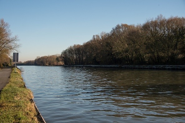
Most global carbon-budgeting attempts presume a straight stream of fluid from land to sea, ignoring the intricate interplay of streams, rivers, lakes, groundwater, estuaries, mangroves, and other ecosystems.
Climate change scientists are now delving into the complexities of interior and coastal rivers to better understand how carbon is stored and moved.
The findings have far-reaching consequences for implementing the carbon computations that are part of global climate agreements.
Terrestrial and marine ecosystems have a massive influence on the climate
A research co-led by climate scientist Laure Resplandy, an assistant professor of geosciences at the High Meadows Environmental Institute at Princeton University, delves into the complexities of marine and inland rivers.
The research, which was published in the current edition of the magazine Nature, has substantial consequences for enforcing the carbon estimates that are part of global climate agreements.
Terrestrial and aquatic habitats have a significant impact on climate through controlling the amount of carbon dioxide in the atmosphere, as per Science Daily.
However, these ecosystems are sometimes seen as separate from one another, ignoring the transport of carbon from land to the open ocean via a complex network of water bodies the continuity of streams, rivers, estuaries, and other bodies moving water from land to sea.
The research team from Belgium, the United States, and France revealed that this land-to-ocean aquatic continuity (LOAC) contains a significant quantity of anthropogenic carbon.
Thus, although often thought, the carbon extracted from the atmosphere by terrestrial ecosystems is not entirely stored locally, which has ramifications for global accords that compel countries to declare their carbon inventories.
The researchers also discovered that natural land-to-ocean carbon flow was more than previously anticipated, which has far-reaching consequences for the evaluation of anthropogenic Co2 absorption by the land and water.
The major goal of the researchers' work is to analyze the economic consequences of climate change for inland waterways transport while accounting for the uncertainty associated with climate forecasts.
According to Forecasting the impacts of climate change on inland waterways, they concentrate on the effects of droughts on four significant Rhine and Danube ports.
Using high resolution estimates of future water flows based on many long-term climate model runs their technique estimates the number of days that water levels at each site analyzed would be below the limit chosen for each kind of ship and measures the cost or benefit in relation to the historical frequency of such incidents.
Measuring the impacts of droughts on inland waterways
The researchers integrated more than 100 independent investigations of the continuum's many components in one study. This synthesis resulted in the development of LOAC carbon budgets for two time periods: the pre-industrial period and the present.
Their findings support the well-known pre-industrial carbon "loop," in which carbon is taken up from the environment by ecosystem types, transmitted to the ocean via rivers, and then returned to the atmosphere.
"We discover that the quantity of carbon transferred by this natural land-to-ocean loop, 0.65 billion tons per year, is almost 50% larger than previously anticipated," Resplandy explained.
Furthermore, this loop is made up of two smaller loops: one that transports carbon from biomes to inland waterways and another that transports carbon from coastal vegetation to the open ocean.
Droughts and the accompanying low water levels have an impact on the operation of IWW.
High tides are intimately tied to discharges and riverbed morphology in a given section of the river, hence the connection between water levels and outflows must be place specific.
Because the topology of the riverbed varies over time, comparing water levels over lengthy time periods is challenging.
As a result, instead of water levels, discharges are typically utilized for relevant sorts of study.
To determine essential discharge levels, we combined daily discharge numbers with data on the connection between water depth and outflows in this study.
© 2026 NatureWorldNews.com All rights reserved. Do not reproduce without permission.


