When the undersea volcano near the Pacific island nation of Tonga erupted in 2015, it created a new island within the Polynesian nation of Tonga.
Scientists originally thought that the island would wither away with the sea waves in a matter of months, which is often the case for small volcanic islands, however, the island did not just stand still until today, but even grew dramatically.
New satellite imagery of the volcanic island showed complete devastation after the recent volcanic eruption of the Hunga Tonga volcano. It was initially speculated that the blast had expanded the island, but new imagery from the United Nations Satellite Centre shows otherwise.
According to Copernicus EU on Twitter, the first image captured after the destructive eruption of Hunga Tonga showed complete wipe out of the volcanic island.
In fact, the damage from the eruption appears to be so severe that nearly the entire island is no longer visible from above.
The island will stick around for some time
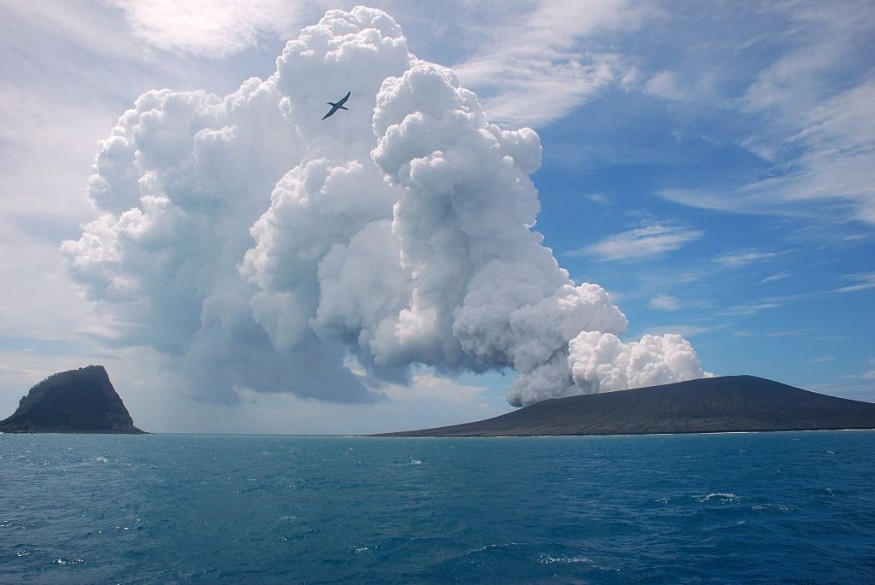
Geography taught us that the cooling lava coming out from a volcano brings out matters from underneath the Earth's crust to the surface, creating a new landmass and basalt rock formations which takes many years to form. However, the underwater volcanic eruption last weekend that rocked the nation and sent tsunami warnings has added nearly 50 percent landmass to a tiny island it had created seven years ago.
"[The eruption] destroyed a large section of the 120-meter tall tephra cone left by the last eruption, and completely filled its crater lake with new material," said Dan Slayback, a research scientist at NASA's Goddard Space Flight Center in Maryland, and has studied this island since its formation.
"Planet's PlanetScope imagery captured the first clear view of the new island structure on 2 January 2022," Slayback notes. The before and after PlanetScope imagery revealed that the surface area of the island appears to have expanded by nearly 45% due to ashfall. At the moment, the volcano seems to have quieted down.
Slayback and his team continue their study of Hunga-Tonga Hunga-Ha'apai. "We are now working to quantify the volume of ejected material using satellite observations, such as those available from Planet's SkySat constellation."
A relatively rare event
Although the eruption started off as relatively small and innocuous, Hunga Tonga-Hunga Ha'apai Hunga Tonga-Hunga Ha'apai changed appearance in 24 hours.
According to the National Geographic report, "after a moment of calm earlier this month, its eruptive activity turned increasingly violent. The middle section of the island vanished on satellite imagery. Towering columns of ash began to produce record-breaking amounts of lightning."
"The thing just went gangbusters," says Chris Vagasky, meteorologist and lightning applications manager at the Finland-based weather measurements company Vaisala. "We were starting to get 5,000 or 6,000 events per minute. That's a hundred events per second. It's unbelievable."
Early in the morning on January 15, the volcano produced a colossal explosion and caused a tsunami hit Tongatapu, the kingdom's main island and home to the capital Nuku'alofa, just a few dozen miles to the south of the volcano.
According to recent research on the geologic history of the volcano, "this powerful paroxysm is, on human timescales, a relatively rare event: Such an explosion is thought to occur roughly once every thousand years."
© 2026 NatureWorldNews.com All rights reserved. Do not reproduce without permission.


