Significant rainfall is good news for the southeastern United States, which has been experiencing extremely dry or even drought conditions in recent weeks.
Severe Weather in Florida
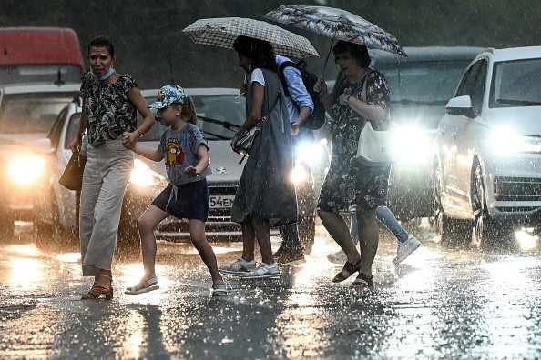
As a storm moves through, AccuWeather experts warn that it may prompt severe weather in Florida.
According to the United States Drought Monitor, areas from northern and western Georgia through most of the Carolinas and southern Virginia are in the greatest need of rain.
Approximately 42% of North Carolina and 23% of South Carolina are now experiencing extreme drought conditions, according to the USDA. North Carolina's city of Asheville has gotten about one-eighth the amount of rain it normally receives in the six weeks since Nov. 1.
The first half of December has seen little to no rain in certain portions of Florida. It's normally the driest time of year in Florida in the autumn, winter, and early spring. There is an average of 1-3 inches of rain every month between November and March in Orlando, according to Accuweather.
Thunderstorms in the system's warm sector are influenced by how quickly the storm builds power as well as the path it takes as it moves through the area.
Southeastern States to Experience Rainfall
Some areas of the Southeastern states will get drenched from Monday through Tuesday, but AccuWeather Meteorologist Tony Zartman says there is some uncertainty as to how far north the rain shield will extend.
In addition, there is a possibility that soaking rain and wet travel conditions would spread further northwest with the storm from middle Alabama and northern Georgia to central North Carolina and southeastern Virginia.
North Carolina's Pilot Mountain State Park was evacuated in late November due to a wildfire that burned for many days. More than 1,100 acres of land were destroyed by the fire, which is thought to have started as a campfire.
This area and most of the southern Appalachians and foothills are still experiencing dry soil conditions, with dry brush and recently fallen leaves providing potential fuel.
This time of year, even a little bit of rain may go a long way since evaporation rates are lower than in the summer.
The recent record-breaking heat and regular above-average temperatures have resulted in much greater evaporation rates than is typical. There has been a 4-8 degree Fahrenheit increase in average temperatures in the first half of December.

Potential Thunderstorms in Central and Southern Florida
In early to mid-December, temperatures in most of the area are typically in the upper 50s, but there have been many days this month when those temperatures have soared into the 60s and 70s.
Zartman said that the more north and west the rain falls, the greater the storm and the faster it increases.
It's possible that rain won't make it all the way to Interstate 85 if the storm weakens before it leaves the beaches of Georgia and Florida. It's possible that if the storm intensifies fast, it will reach as far north as the southern Appalachians, and even farther west.
From late Monday to early Tuesday, central and southern Florida could possibly see heavy, gusty, severe thunderstorms, even with a moderate storm system.
It's possible that light rain may fall throughout the afternoon and evening of Tuesday, even if severe thunderstorms don't form in the region. People who want to go fishing, boating, or to the beach this week may want to think about their travel plans.
Related Article : Flood Hits Southwest France After Torrential Rain, Prompting Evacuation
For more news, updates about torrential rain and similar topics don't forget to follow Nature World News!
© 2026 NatureWorldNews.com All rights reserved. Do not reproduce without permission.


